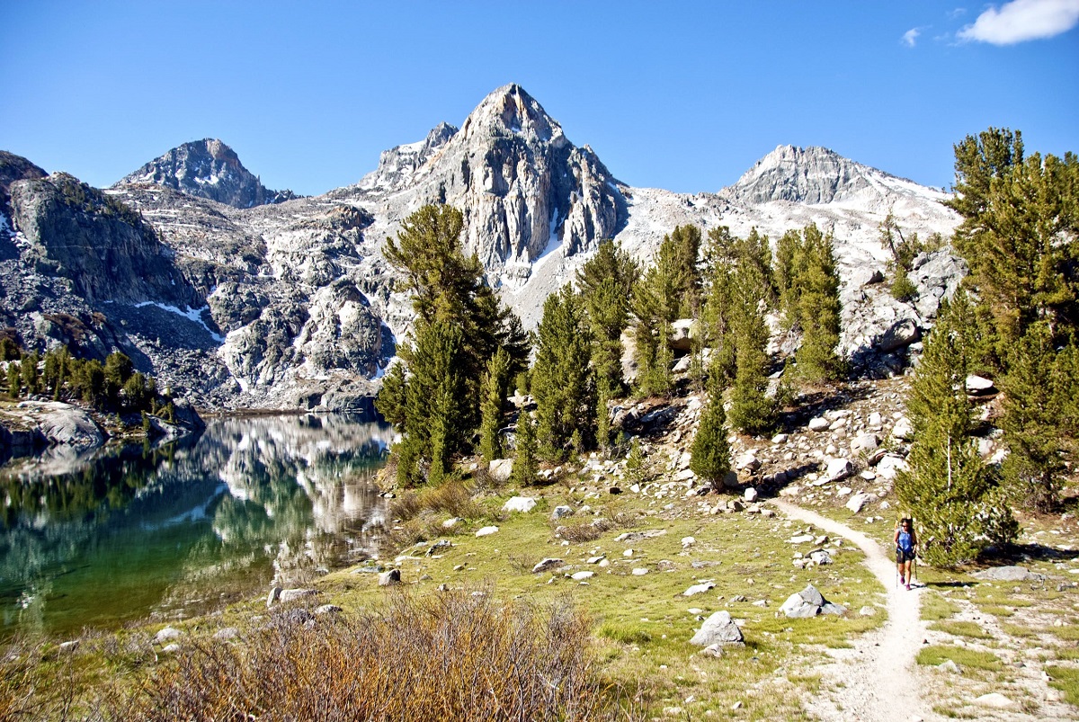
If you’re planning to take up the 52 hike challenge, you are sure to add some of the trails in California to your list. With the Sierra Nevada Mountain landscape, redwood forests, cliff-lined beaches, and dramatic waterfalls, trails in the Golden State are abundant, offering a fun and adventurous experience. Depending on your skill level, you can choose one. The Yosemite National Forest is home to many trails, leading to majestic waterfalls and unique rock formations. Jedediah Smith Redwoods State Park is also a must-visit to hike the paths running through giant old-growth redwood trees.
Among these, you will find some trails to be pretty challenging. Know your limits well, and only then plan for the hike. Do carry all the essentials, including sufficient drinking water and hiking poles. Many of them are steep and exposed to heat, hiking along which have also caused deaths due to dehydration.
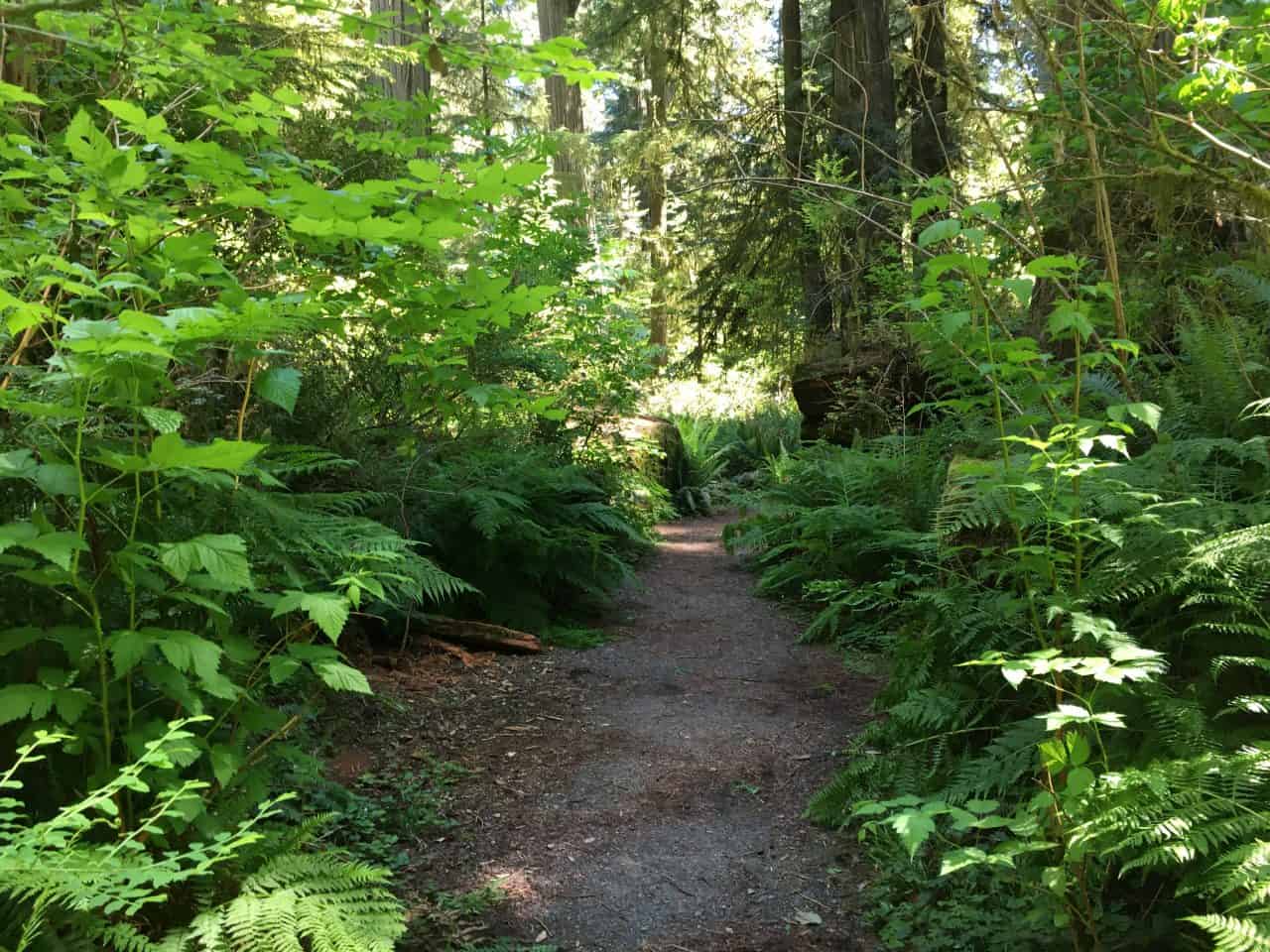
The family-friendly Simpson-Reed Trail is a part of Jedediah Smith Redwoods State Park. Gorgeous, massive redwood trees dot the relatively flat path, offering one a serene experience in the woods. Look out for the informative signs on the way that provide helpful insights about the area’s foliage. You will find the trailhead near Highway 199, just about a mile away along Walker Road.
Length: About 1 mile
Difficulty: Easy
Best time to visit: All year long
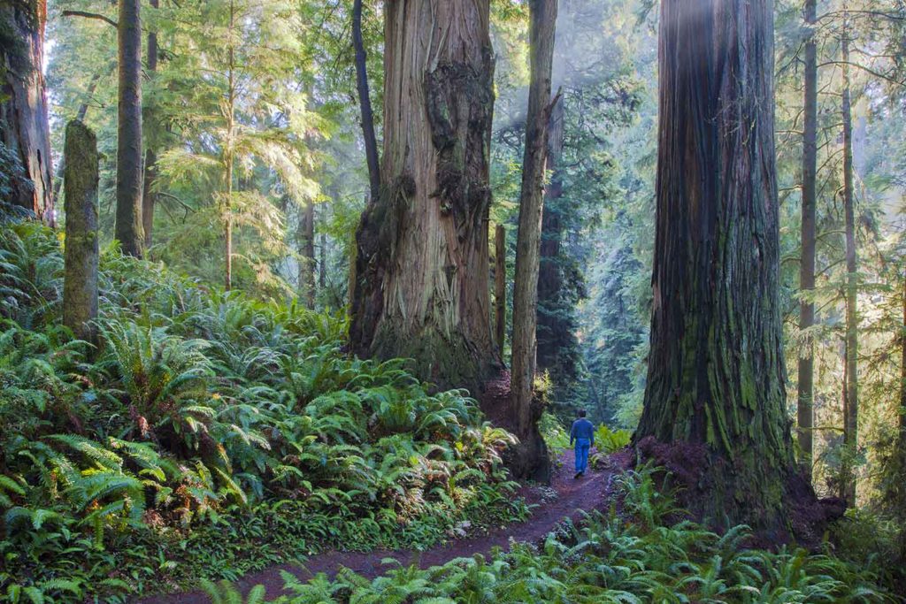
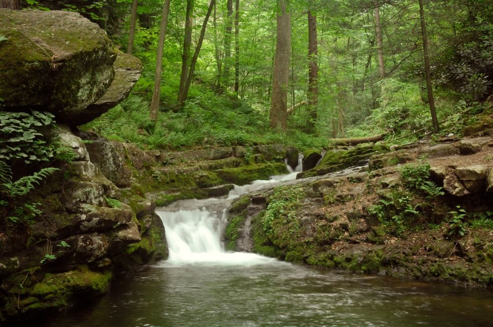
Boy Scout Tree Trail is a well-known trail in Jedediah Smith Redwoods State Park. As you begin your hike, the giant old-growth redwood trees surrounding you provide a serene setting to enjoy. Despite the switchbacks and exposed roots, it is worth the trip along the path which meets Fern Falls at the end. Make sure to visit it after a good rainfall to see it flow in a gush.
Length: About 7 miles
Difficulty: Moderate
Best time to visit: All year round
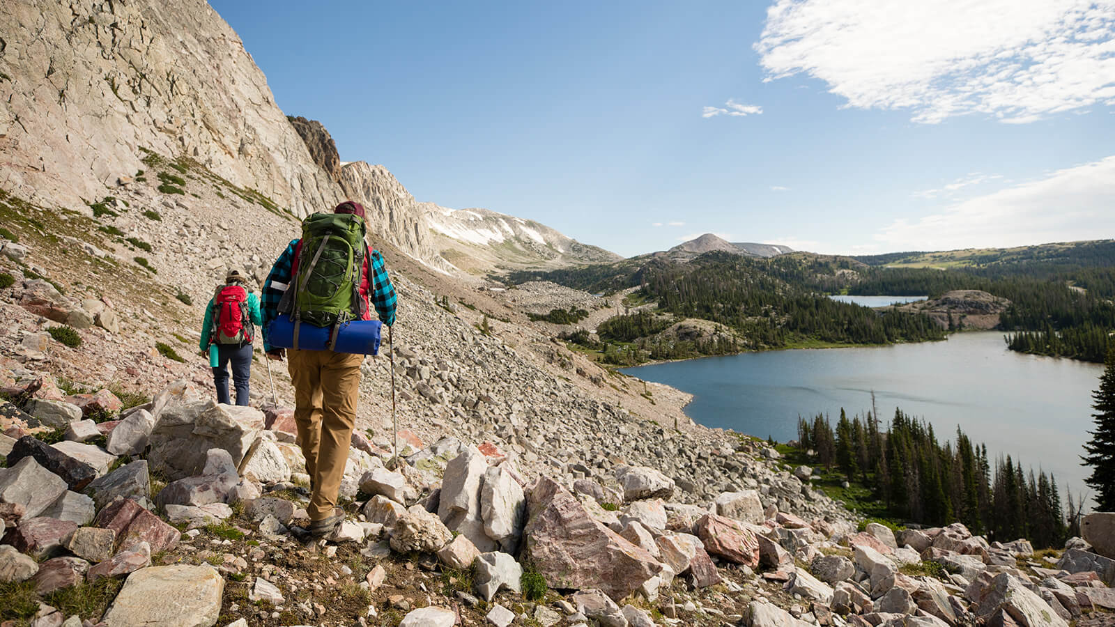
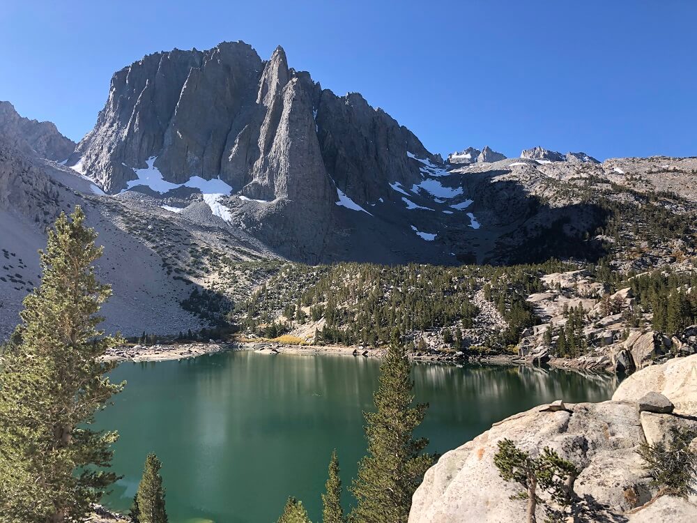
John Muir Trail is one of the best multi-day hikes in California. It’s a spectacular part of the Pacific Crest Trail that provides breathtaking views as it runs through Yosemite, Kings Canyon, and Sequoia National Park. Despite being steep and rugged, the surrounding 14000 feet tall mountains, pristine lakes, and scenic canyons and cliffs make the strenuous hike completely worthwhile. On your way, make sure to pause and take in the views of the towering Mt. Whitney and of the Painted Lady, a stunning peak overlooking the Rae Lake at Kings Canyon National Park. Another attraction that deserves a special mention is General Sherman, a 2200-year old giant sequoia tree in Sequoia National Park. Keep in mind to acquire a pass for hiking the Yosemite section.
Length: About 210 miles
Difficulty: Hard
Best time to visit: May to October
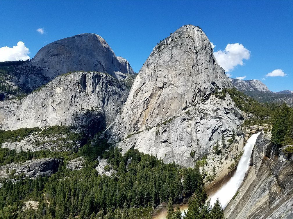
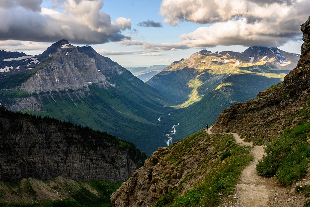
Hiking up Half Dome within Yosemite National Park via Mist Trail is one of the hardest Californian hikes. Though you’ll find many visitors admiring the famous rock formation, climbing it is not for the faint of hearts. The trail starts with a steady incline through the woods, and rock scrambles to reach the sub dome. The views of waterfalls and forests along the way are pretty impressive. However, the real challenge begins when you get to the base of Half Dome. The steep inclines require the help of cables to make it to the top. Do wear your gloves for a sturdy grip and carry plenty of water. The breathtaking view of the Yosemite Valley from the top is absolute bliss. Remember to acquire your permits before you plan to attempt the hike.
Length: About 14 miles (out and back)
Difficulty: Hard
Best time to visit: May to October
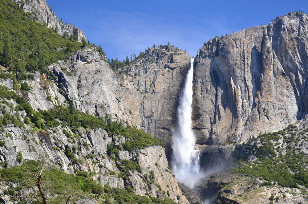
While the lower Yosemite Falls Trail is more popular and easy to access, the hike along the upper trail is indeed rewarding. Though the path is extremely steep and rocky, it will lead you to the top of the waterfall from where you can soak in its beauty as it drops 2,425 feet in all its grandeur. In addition, you’ll also be able to witness the Yosemite Valley and the stunning rock formations. Wearing a good pair of hiking shoes will help you hike along the slippery rocks. A campground is available nearby in case you want to spend overnight here.
Length: About 7.6 miles
Difficulty: Hard
Best time to visit: April to October
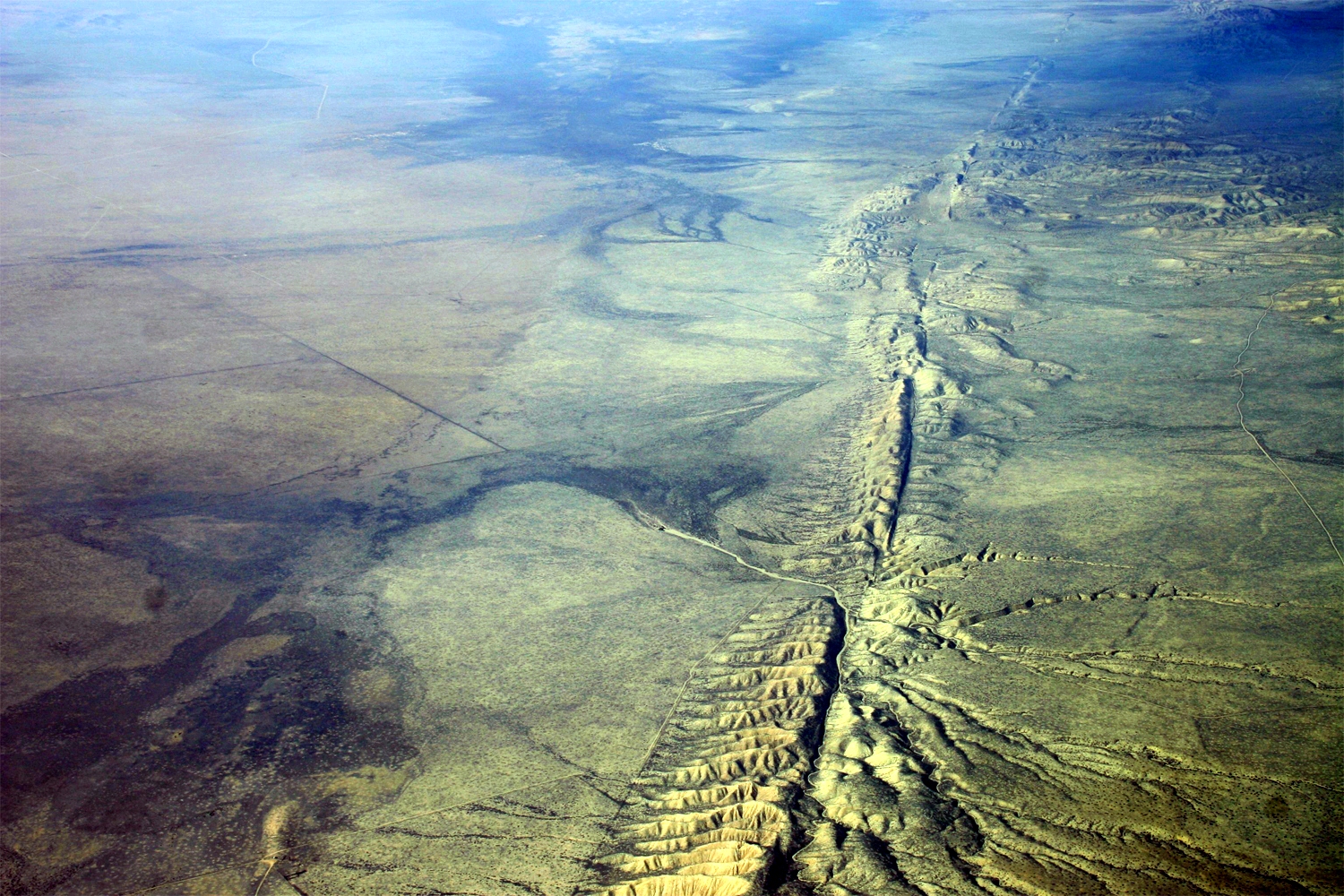
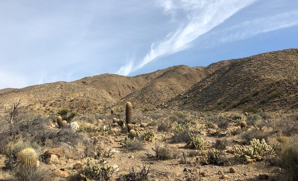
This short trail in Carrizo Plain National Monument will give you interesting insights into earthquake geology. Though slightly steep in the beginning, it continues on a flat surface. Hiking it in spring is perfect for witnessing the wildflowers blooming all around along with the gorgeous San Andreas Fault. The informative signs along the way provide a better understanding of the area’s geology. You can continue uphill from the trail’s end by scrambling over rocks for more impressive views . Here you will see the zigzag course created by the faults along which the stream flows.
Length: About 1.6 miles (out and back)
Difficulty: Easy
Best time to visit: Spring
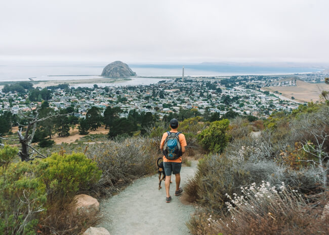
This short but steep trail is within Morro Bay State Park on the central coast of California. It takes you to the hilltop from where you can enjoy the sweeping views of Morro Bay, the beach, and the surrounding volcanic mountains. Wearing good hiking shoes is recommended for hiking the rocky sections.
Length: About 2.5 miles (out and back)
Difficulty: Moderate
Best time to visit: All year round
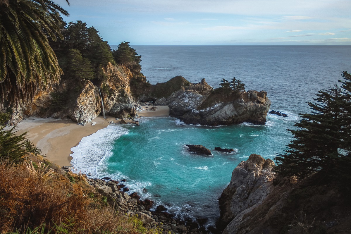
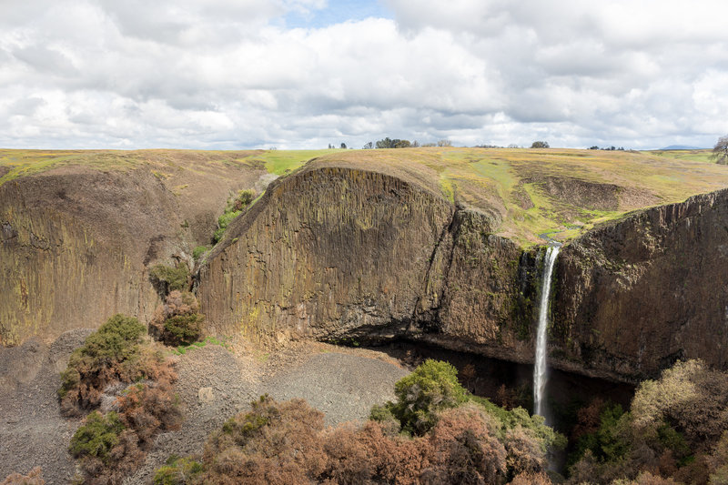
McWay Waterfall is a famous attraction in Big Sur. It is a short trail starting from the campsites in Julia Pfeiffer Burns State Park that leads to the overlook. From here, you can witness magnificent views of the 80-foot waterfall tumbling down from a granite cliff directly onto the beach. It’s a must-do hike in Souther California. However, do keep in mind not to attempt scrambling down to the beach area as the path is dangerous and considered a punishable offense.
Length: About 1.2 miles (loop)
Difficulty: Easy
Best time to visit: September to December
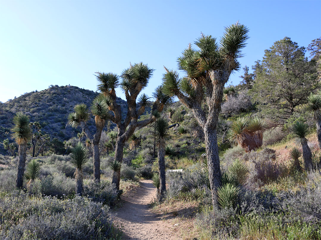
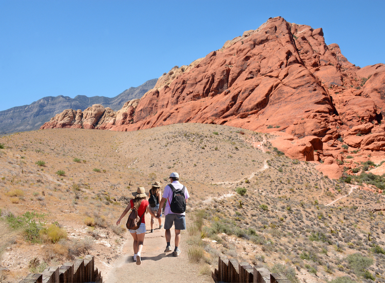
If you’re in Joshua Tree National Park, hiking this trail will provide you with some of the best views of the surrounding. The path is mostly sandy giving one the feeling of walking on the beach. It has some elevation gains, but as they’re not overly steep, hikers of any level can access it. The canyon and other rock formation views, along with lush valleys filled with colorful wildflowers, make it a truly mesmerizing hike. A weekly pass is required to enter the national park, which would cost you around $30 per vehicle, $25 per motorcycle, or $15 per pedestrian.
Length: About 6.2 miles (loop)
Difficulty: Moderate
Best time to visit: All year round
This 2,653 mile-long trail stretches from Mexico to the borders of Canada. It enters the southern part of California from the Mexican borders. The diverse terrains it covers while making its way to central and northern California through various national parks provide a breathtaking experience to hikers.
You can choose to hike smaller portions of the legendary trail. The Donner Pass to Squaw Valley section would be ideal for a long hike. It’s pretty strenuous with spectacular views of wildflowers and mountains. Though it requires about 7 hours to reach the end, inexperienced hikers can consider completing it in two days by taking breaks in between. As the trail lacks shades, make sure of carrying plenty of water.
You can tread along Sonora Pass to the Latopie Lake section for a shorter yet challenging day-hike. Despite the elevation gain and rocky terrains, hikers will be rewarded with the awe-inspiring views of the Sierra mountains, alpine lakes, towering cliffs, and meadows colored with wildflowers.
Length: Donner Pass to Squaw Valley (about 17.7 miles, point to point), Sonora Pass to Latopie Lake (about 4.6 miles, point to point)
Difficulty: Donner Pass to Squaw Valley (Moderate), Sonora Pass to Latopie Lake (Hard)
Best time to visit: June to October
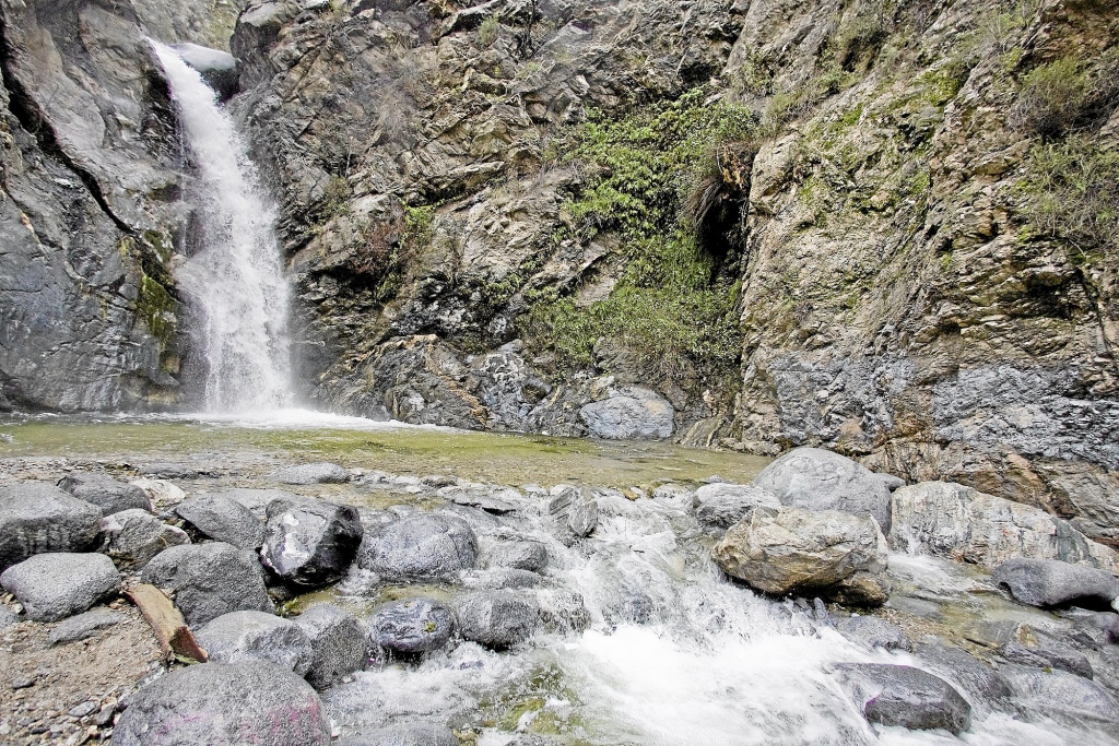
Eaton Canyon Trail is pretty famous due to its easy accessibility and proximity to California’s major cities, including Los Angeles, Pasadena, Altadena. Despite the crowd, especially during the summer weekend, you will not regret visiting it. With minimum elevation gain and several creek crossings, it leads to a 40-foot splendid waterfall and a small pool surrounded by San Gabriel Mountains and Santa Monica Mountains. However, as you come closer to the waterfall, the path gets rockier. Do wear good waterproof shoes or carry an extra pair as your feet are sure to get wet. Apart from this, you will be treated with the views of spring wildflowers dotting the canyon floor. One of the nicest places to hike in Calofirnia, Eaton Canyon is also ideal for you to take your dogs for a walk on leash.
Length: About 4.4 miles (out and back)
Difficulty: Easy
Best time to visit: All year round
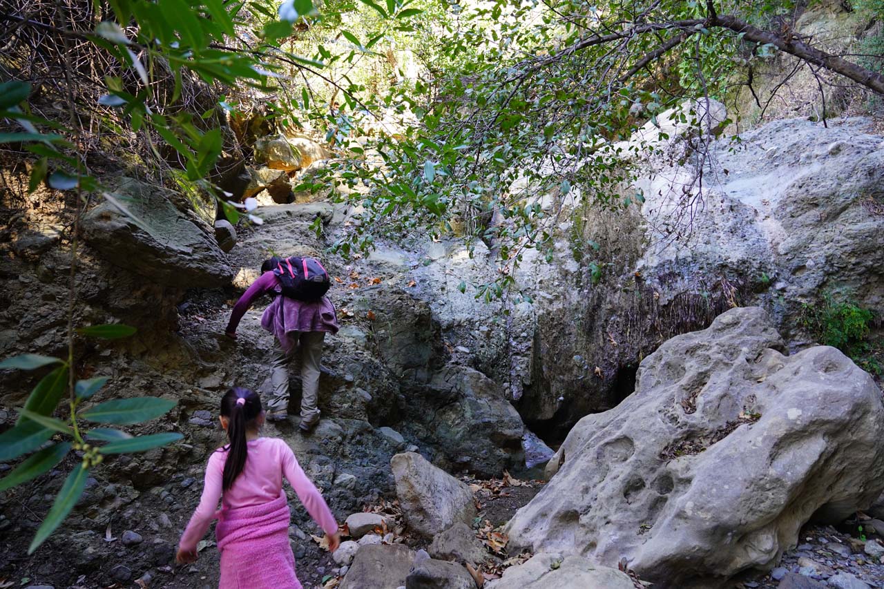
One of the hidden trails in southern California, Black Star Canyon Trail is in a remote part of Cleveland National Forest. If you’re a brave soul looking up for some adventure, you can attempt hiking it as many hikers have reported experiencing paranormal activities here. Despite being haunted, it is a fun day-hike taking you to Black Star Canyon Falls via a rocky terrain. Though it initially begins along a dirt path with gradual inclination, the last portion requires scrambling past rocks and boulders. Do be prepared to get your feet soaked as you will also have to cross the creek multiple times. However, the mesmerizing sight of the waterfall at the end is totally worth the strenuous hike. If you go towards its right, you will find an uphill route leading to the waterfall’s top from where you can get additional views. It is steep and slippery but you will find ropes to support you.
Length: About 6.7 miles (out and back)
Difficulty: Hard
Best time to visit: All year round
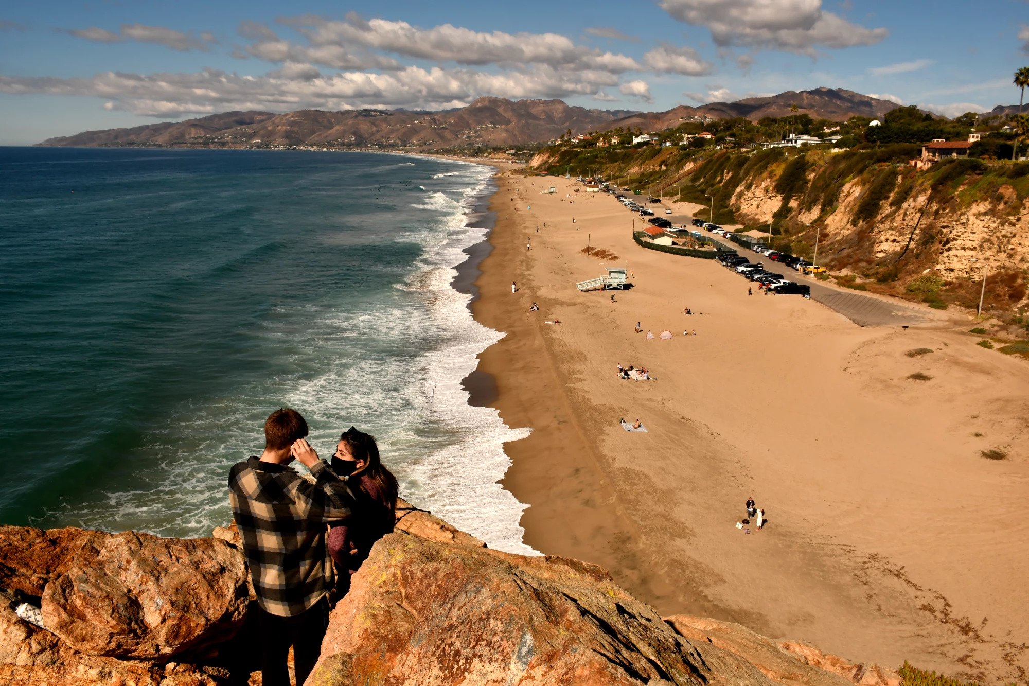
This trail is a long-distance route stretching about 1200 miles from Mexico to Oregon along the Pacific Coastline. It attracts hikers to experience the various terrains, from sandy beaches to rugged, dirt paths. In addition, the wildflowers, cypress trees, tide pools, waterfalls, and coastal cliffs elevate its beauty. You can hike the short section starting from 25th Avenue Gate near Baker Beach. The hike takes less than an hour to complete. You will pass through forested areas and bluff-lined shorelines along the Pacific Ocean before ending at the iconic Golden Gate Bridge. An ideal beach hike in southern California, you can pause at the Pacific Overlook or Golden Gate View Point on the way to take in the beautiful views.
Length: 25th Avenue Gate to Golden Gate Bridge (About 2.4 miles)
Difficulty: Easy to Moderate
Best time to visit: All year long
This loop trail near the Sierra Madre consists of Upper and Lower Winter Creek Trails. It takes you to the pretty Sturtevant Falls, which cascades down from 50 feet. Due to the pretty steep inclines, it is considered moderately challenging. Many hikers prefer treading along in the counter-clockwise direction to end it with an easy downhill walk to the parking lot. The canyon and mountains like Mt. Wilson, Chantry Flat, and Mt. Zion add charm. The trail being shaded mostly makes it a pleasant summer hike.
Length: About 5.6 miles (loop)
Difficulty: Moderate
Best time to visit: All year round
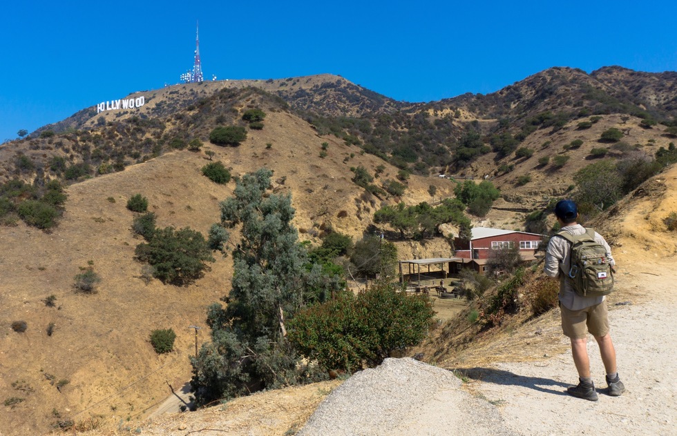
This popular trail in Griffith Park offers incredible views of the famous Hollywood sign. In addition, you will also enjoy witnessing the surrounding mountains and cityscape. The trail has some steep points and very little shade. Hence, it is better to hike early morning or late in the day.
Length: About 5.10 miles (out and back)
Difficulty: Moderate
Best time to visit: All year long
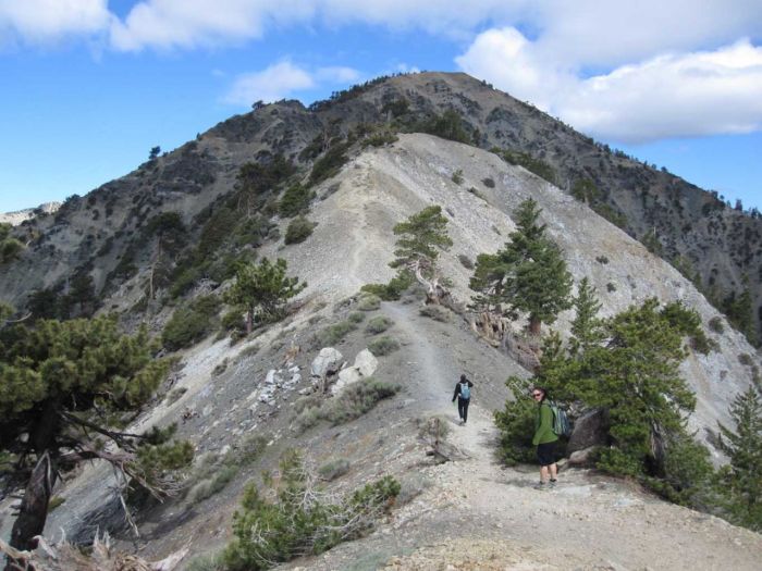
You will find numerous trails in the Mount Baldy area. Among these, you can choose hiking to Bridge to Nowhere via East Fork Trail. It’s a rocky path running parallel to the East Fork of the San Gabriel River, leading to the 130-foot historic bridge. You will also have to cross the creek multiple times. However, the forest and rugged canyons elevate its beauty. The entire out and back hike will take you about 5 hours to complete.
Length: About 9.5 miles (out and back)
Difficulty: Moderate
Best time to visit: All year round
If you’re planning a short family outdoor adventure in southern California, this trail in Angeles National Forest would be ideal for hiking. It takes you to Table Mountain, where you can enjoy spectacular views of the surroundings. Though it starts as a steep climb for about a mile, the path then eases off and becomes easier to hike. All along, you will be greeted with beautiful wildflowers. Do bring a trail map to avoid confusion about finding the way.
Length: About 5.4 miles (out and back)
Difficulty: Moderate
Best time to visit: All year long
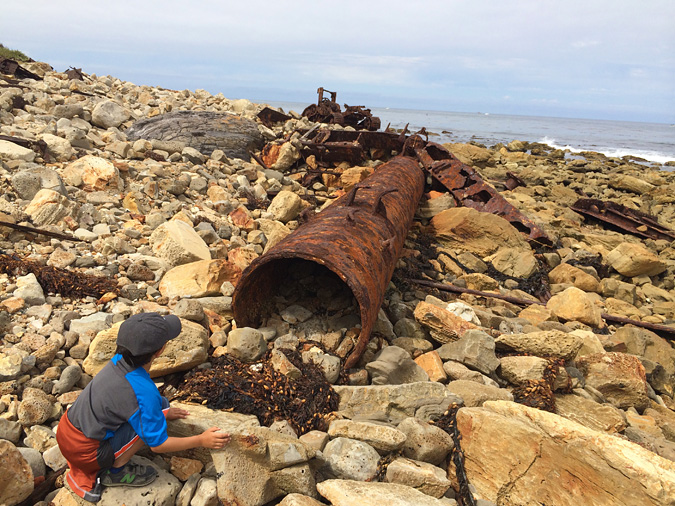
History enthusiasts can consider hiking this trail in the Palos Verdes Peninsula area. It will lead you down along a beach to the shipwreck site. Though you can enjoy the ocean and bay views, be prepared to hike on the extremely rocky terrain all the way. If you want to avoid it on your return, you can follow the large drainage pipe that will lead you to the road. Do put on a pair of sturdy hiking shoes to trudge over the rocks.
Length: About 4.6 miles (out and back)
Difficulty: Moderate
Best time to visit: All year round
TOP PICKS
Best Waterfall Hikes: Yosemite Falls Trail, Eaton Canyon Trail, McWay Waterfall Trail
Best Beach Hikes: California Coastal Trail
Best Camping Hikes: Yosemite Falls Trail, Pacific Crest Trail, John Muir Trail
Best Mountain Hikes: Mount Baldy Trail, Black Hill Trail, Eaton Canyon Trail
Best Dog-Friendly Hikes: Hollyridge Trail, Eaton Canyon Trail
Best Winter Hikes: McWay Waterfall Trail, Yosemite Falls Trail
Best Fall Hikes: Joshua Tree Short-Loop and Canyon View Trail, Mist Trail and Half Dome, John Muir Trail
Best Kid-Friendly Hikes: Simpson-Reed Trail, Joshua Tree Short-Loop and Canyon View Trail, San Andreas Fault Trail
Best Wildflower Hike: Joshua Tree Short-Loop and Canyon View Trail, Eaton Canyon Trail, Pacific Crest Trail
Best Overnight Hikes: John Muir Trail, Pacific Crest Trail

Hello there! My name is Jay and I run this website. I'm a full-time traveler and freelance writer. This is where I share travel advice and help people pursue their traveling dreams.
You can learn more about me and my mission on the about me page.
It's nice to have you here :)