If you are an avid hiker, chances are that hiking some of the trails in Virginia ranks right up there in your bucket list. You could either take to the mountains to get a picturesque view of the surrounding landscape or even visit some of the great waterfalls for a relaxed, refreshing break. The Shenandoah National Park has a plethora of trails, and a spring or fall trip to these spots is for sure to replenish your urge to cherish nature’s beauty.
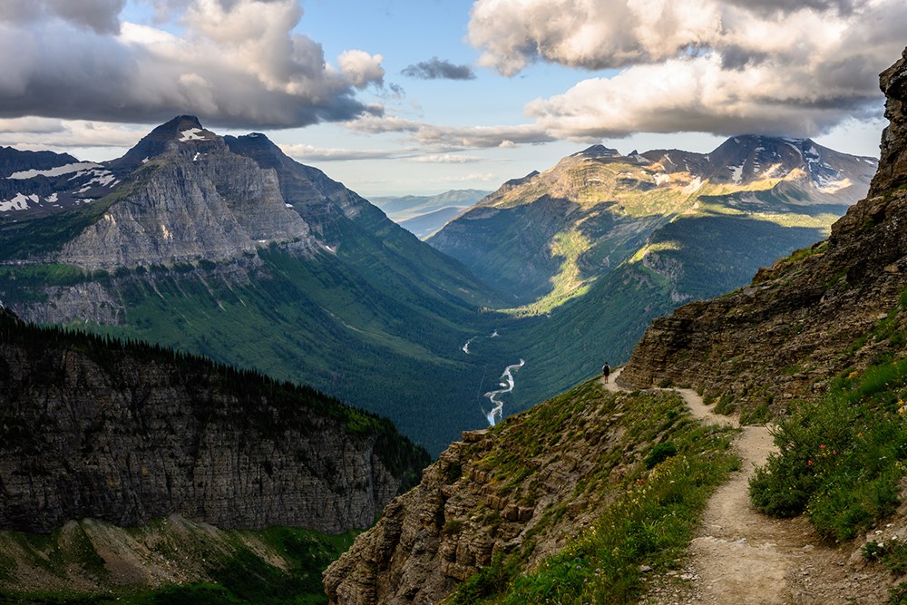
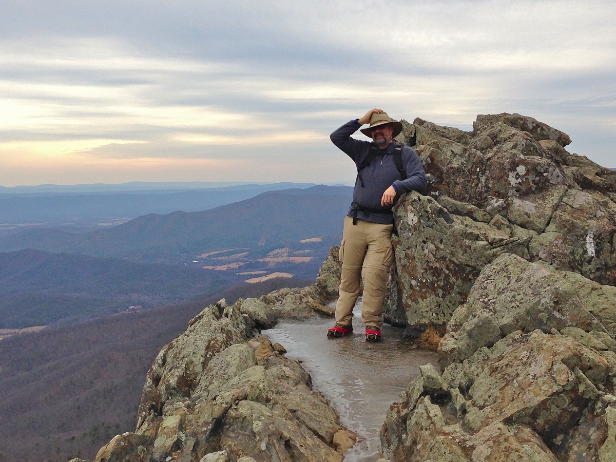
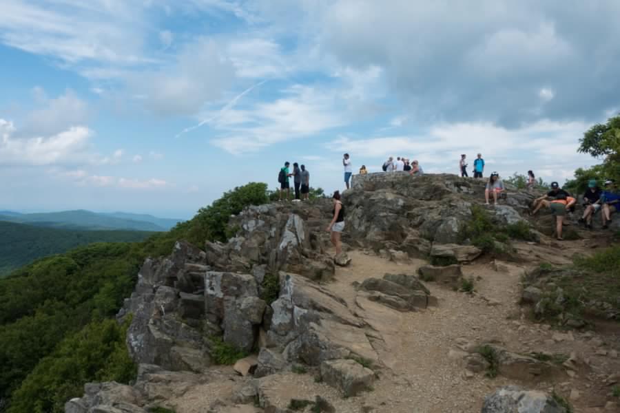
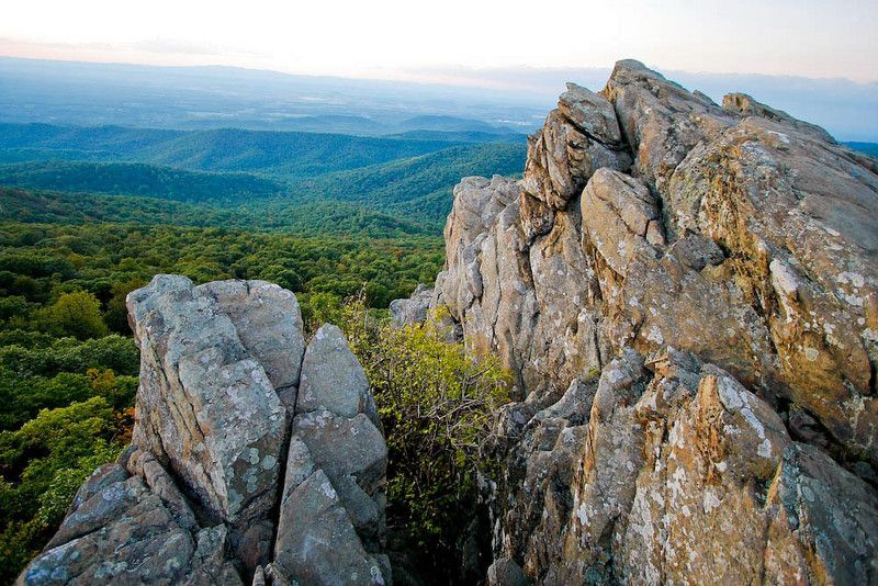
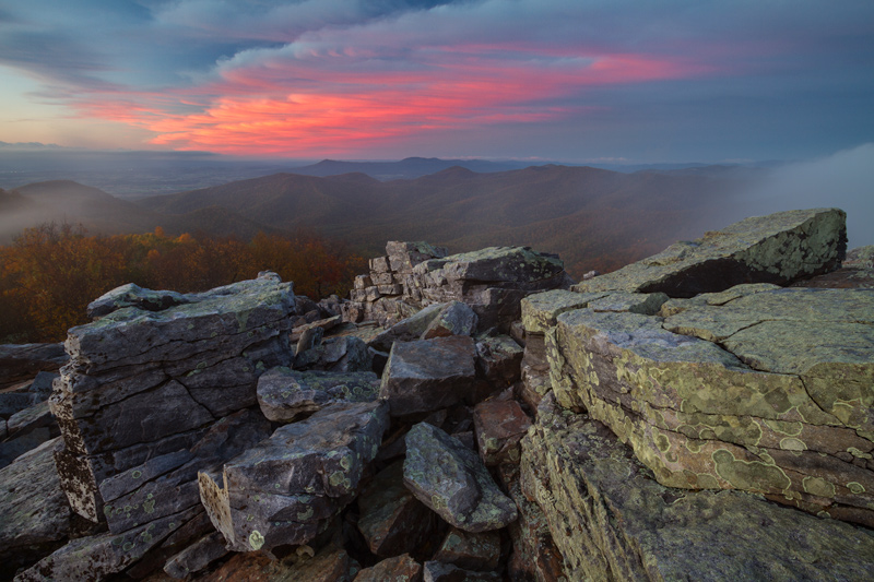
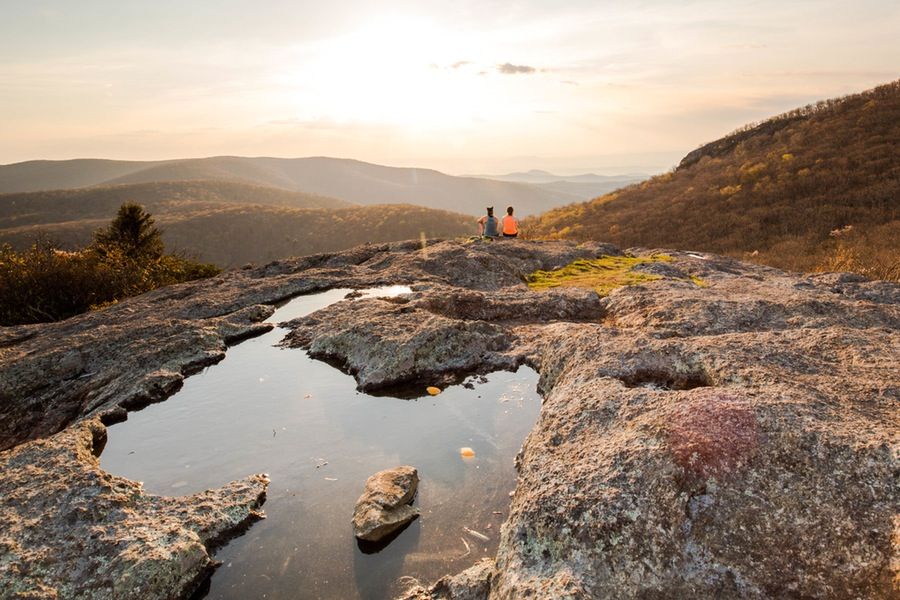
The Old Rag Mountain summit in Virginia’s Madison County is one of the most sought-after hiking spots accessed from the Shenandoah National Park trails. The trail is a crowded one, especially during weekends, and to avoid the rush start at 6 or 7 in the morning. The most challenging part of this difficult trail, covered in 7 to 8 hours, is the rock scrambles stretching for 1.1 miles (1.8 km). The place possesses many false summits, and you will only get to know that you have reached the real one on seeing the brown elevation sign. Rock climbing and camping at designated areas are other activities one can avail of in the Old Rag.
Length: 9 miles (14.5 km)
Difficulty: Hard
Mary’s Rock lying within the Shenandoah National Park in the Rappahannock and Page counties is another preferred hiking spot reached through the trails of Panorama Visitor Center and Meadow Spring Parking Area. The steep Panorama Trail is longer and difficult than the Meadow Spring Parking area one. On reaching the summit, one could get a clear view of the Shenandoah National Park’s northern part as well as the Page Valley. The lovely wildflowers that you spot on your way are sure to give you utmost pleasure.
Length: 3.7 miles (5.9 km) from Panorama Visitor Center; 2.9 miles (4.6 km) from Meadow Spring Parking Area
Difficulty: Moderate (for both the trails)
The McAfee Knob, on the Catawba Mountains, in Virginia’s Catawba community accessed through the Appalachian Trail, is a perfect site for photography as the top of the summit offers a great view of the surrounding mountains and valleys. You could get to this 170 ft point in about 4 hours. The trail, best accessed between April and November, remains crowded during weekends. One could even camp and backpack in the Pig Farm Campsite and other adjacent areas.
Length: 4.4 miles (7.08 km)
Difficulty: Moderate
Stony Man, lying in the Shenandoah National Park, occupying the Page and Madison counties, is reached through the Appalachian Trail. While the route going through the Skyline Resort at the Skyline Drive’s Milepost 41.7 takes lesser time, that from the Skyline Drive’s Milepost 39 is longer, with an increased difficulty level. On reaching the upper slopes, you would catch sight of balsam fir and red spruce trees growing in the nearby areas. The best time to use the trail is from April to September, as the Skyline Drive remains closed in winters.
Length: 1.6 miles (2.5 km)
Difficulty: Moderate
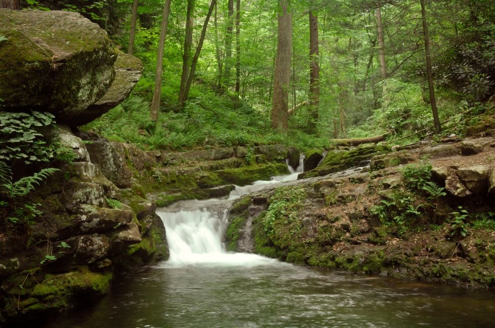
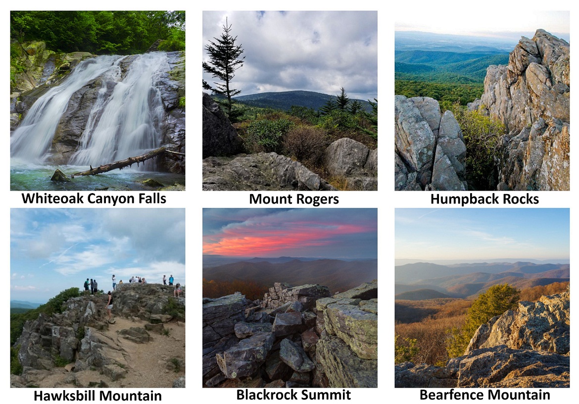
The USP of this trail lies in the six waterfalls between 35 and 86 ft in height and several small cascades. Each of the waterfalls has a swimming hole that mostly remains crowded. One could just hike to the Lower Falls covering a distance of 2 miles (3.2 km), or even go a little higher if they are physically fit to the 86 ft Upper Falls. To get a complete view of all the waterfalls, one must cross a steeper path. The best time to visit is from March to November.
Length: 2 miles (3.2 km) for Lower Falls; 4.6 miles (7.4 km) for Upper Falls; 7.3 miles (11.7 km) for full Whiteoak
Difficulty: Easy for Lower Falls; Moderate for Upper Falls; Hard for full Whiteoak
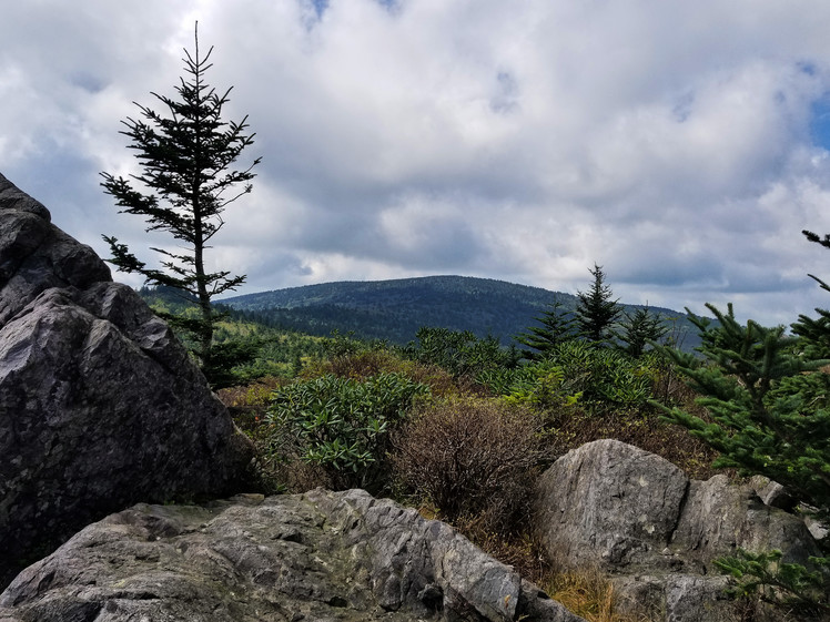
Another of the popular hiking spots in the Shenandoah National Park provides one a complete view of the Blue Ridge Mountains. The rock scramble close to the summit requires some amount of effort to get to. The April – October period is the perfect time to use the trail, with the surrounding sceneries looking the best during spring and fall. The place is secluded, and getting parking does not seem a problem most of the time.
Length: 1 mile (1.6 km)
Difficulty: Moderate
Crabtree Falls, one of the tallest waterfalls in the United States, is situated in Virginia’s Nelson County. The trail, covered in 1.5 – 2.5 hours, is moderately difficult as one will have to cross a steep, rocky terrain. The wet rocks surround the falls are slippery, and should be avoided. On their way, hikers would come across an oak-hickory forest, a perfect destination for bird watchers as they would get to see the dark-eyed junco, black-throated blue warbler, tufted titmouse. Though people come here throughout the year, visiting the place in winters would give an uninterrupted view of the gorgeous falls as summer here remains busy.
Length: 2.5 miles (4.02 km)
Difficulty: Moderate to Hard
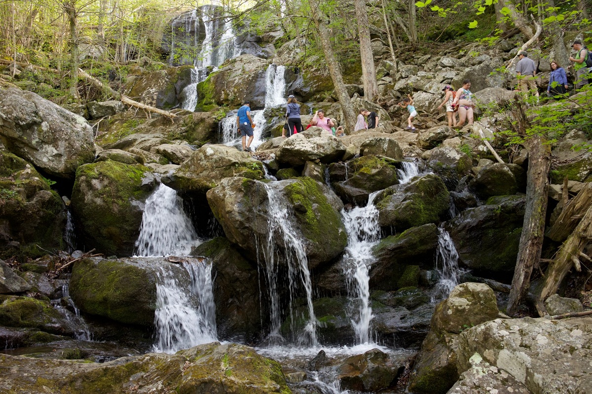
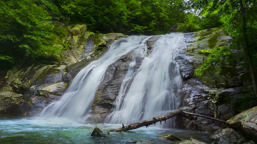
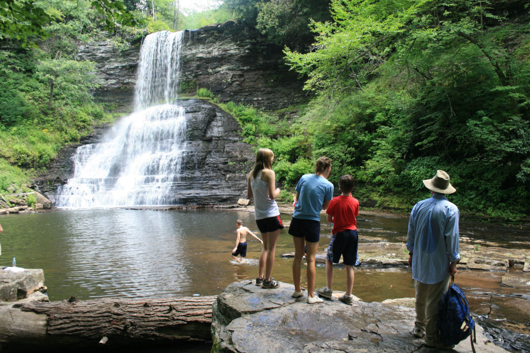
This is one of Shenandoah National Park’s most popular waterfall-cascade series that many people prefer visiting due to the short hiking time. The Hogcamp Branch responsible for its creation is seen at the trails descending sections. The upper falls are bigger, with more water flow. On the other hand, the lower falls pose a picturesque view, ideal for photography, particularly in autumn with leaves scattered all around the rocks and water. The route is mostly smooth, with some sections being steep and a little troublesome to cross. The perfect hiking time is from April to October, though a winter trip to the place would give one a stunning view of the frozen falls.
Length: 1.4 miles (2.2 km)
Difficulty: Moderate
The Sharp Top, situated at an hour’s distance from Lynchburg, and Roanoke cities, is another spectacular site, suitable for hikers of all skill levels, best accessed from March to November. On reaching the summit, the panoramic view of the surrounding Peaks of Otter region would leave tourists in awe. Another exciting sight that you ought not to miss here is the antique stone cottage. The several boulders on top serve as a perfect picnic spot.
Length: 3 miles (4.82 km) roundtrip
Difficulty: Moderate
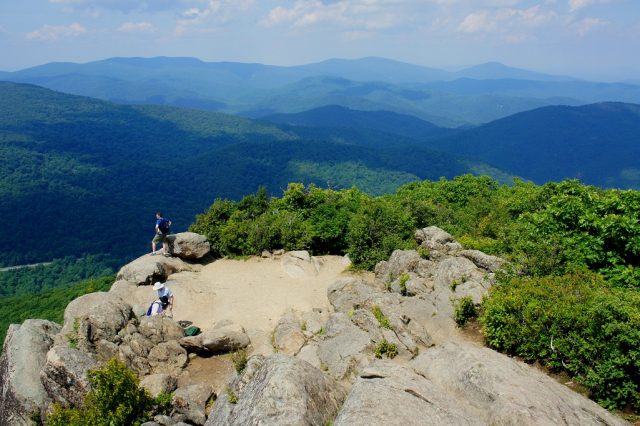
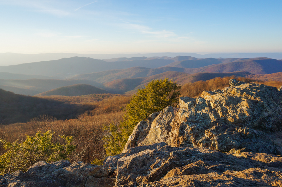
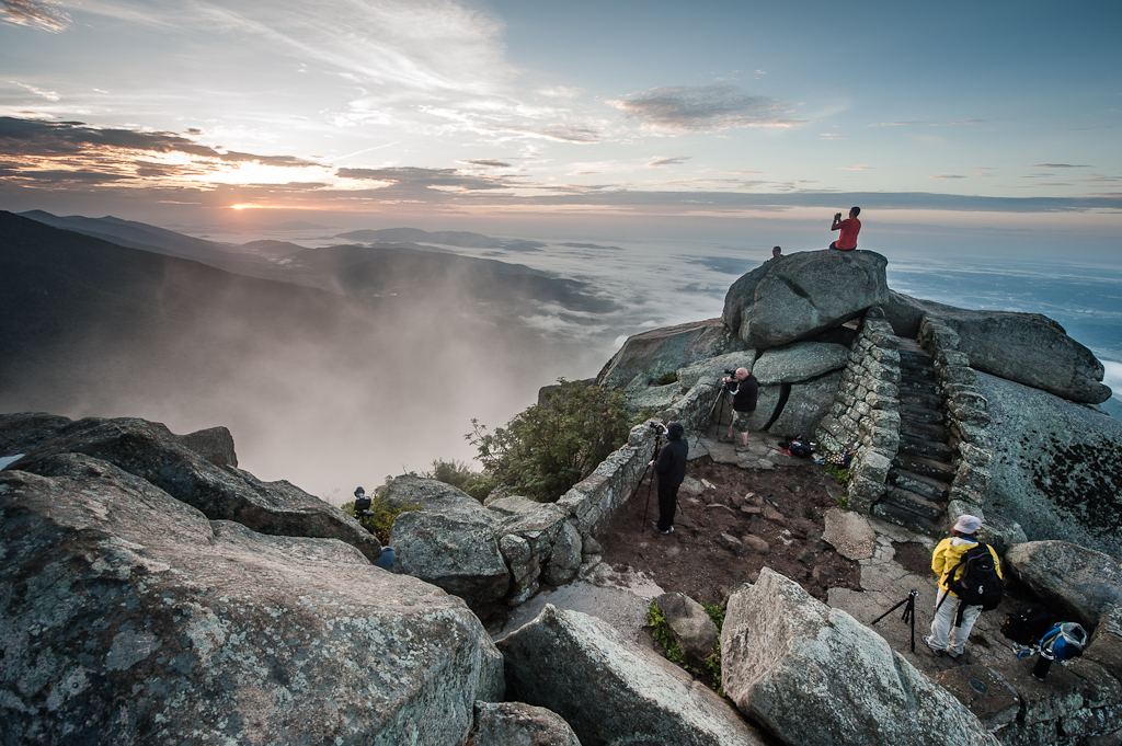
The Hawksbill Mountain on the Madison County – Page County border, located at a 4049 ft elevation, is the Shenandoah National Park’s highest point. The out and back trail starts from Skyline Drive’s Milepost 45.6. The Lower Hawksbill Trail, though steep at the center of the parking lot, is the direct route to the summit. Once you reach the zenith, take pleasure in cherishing the Stony Man to the north, Massanutten Mountain to the west, and Old Rag to the east. The preferred time is between April and October.
Length: 1.50 miles (2.4 km)roundtrip
Difficulty: Moderate
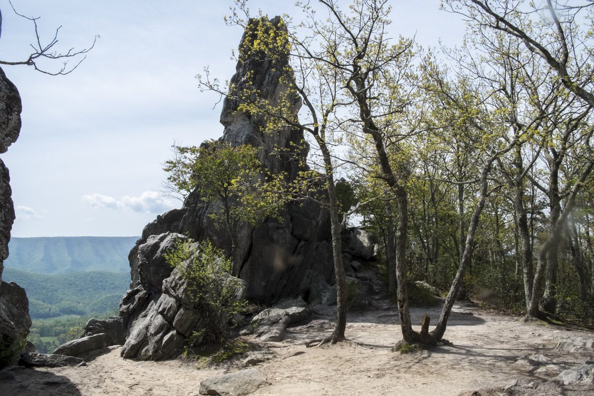
The Dragon’s Tooth, a rock monolith of the Tuscarora quartzite is situated to the western part of Catawba in the Roanoke and Craig counties. It is nearby the McAfee Knob, and some parts of the trail is rocky and steep. The summit of the tooth is difficult to climb, but if you manage to do so don’t miss out capturing photographs of the spectacular views around. The place is perfect to go to between spring and fall.
Length: 4.1 miles (6.6 km)
Difficulty: Hard
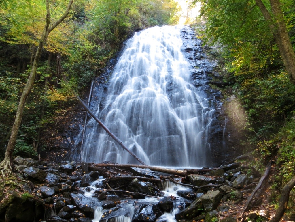
The trail to the 66ft beautiful waterfall within the Jefferson National Forest bounds is an out and back one, covered in a short span. The presence of benches and viewing platforms midway allows one to relax and cherish the scenic beauty. The path is mostly smooth with some moderate inclines, though one would need to access many stairs to reach the falls finally. Besides hiking, you could go on a fishing spree at the Little Stony Creek located nearby. The May- September span is the best time.
Length: 1.42 miles (2.3 km) roundtrip
Difficulty: Easy
The out and back crowded hiking trail to Mount Rogers is a long and difficult one taking about 5 to 6 hours to complete the round trip. Of the several trails leading to this site, the Appalachian and Virginia Creeper are the most prominent ones. You would come across dense vegetation alongside ponies and cattle, roaming around the surrounding countryside.
Length: 12.42 miles (20 km) roundtrip
Difficulty: Hard
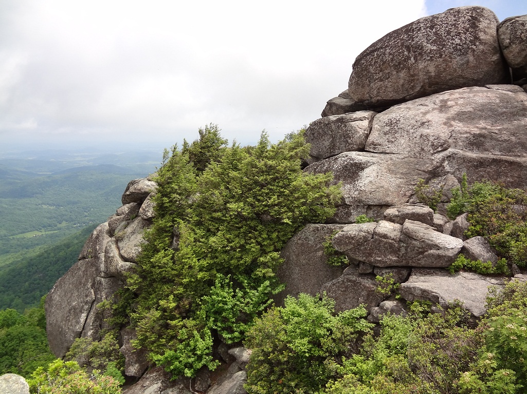
The Humpback Rock adjacent to the Humpback Mountain peak is a popular hiking destination. One needs to travel for just 45 minutes to climb to ascend and another 20 to 25 minutes to descend. The Appalachian Trail, Humpback Rock Trail, Catoctin Trail, and Mountain Farm Trail are commonly accessed. You could view parts of the Shenandoah National Park to your north, stretches of farms in the east, and the George Washington National Forest’s woody, mountainous terrain in the southwest. Consider stopping for a quick lunch at the Humpback Rocks Picnic Area.
Length: 2 miles (3.21 km)
Difficulty: Easy
To reach the Blackrock Summit, one can take the Appalachian Trail from Skyline Drive’s Milepost 84.4 and cover the path in 1 hour. Besides hiking, you may also trek, climb, and camp in the adjacent areas. The ideal time to visit the place is between April and October.
Length: 1 mile (1.6 km)
Difficulty: Easy
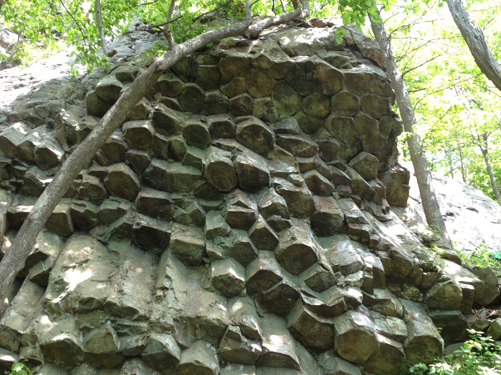
The Compton Peak has two viewpoints, the Compton Peak East and the Compton Peak West, covered in a 2.4-mile (3.86 km) roundtrip when following the Appalachian Trail. The path is a little steep and rocky, with the chief attraction being the hexagonal columnar basalt joint formed 700 million years ago. The place remains crowded mostly during weekends, and the perfect time to go there is from spring to fall (March to October).
Length: 2.4 miles (3.86 km)roundtrip
Difficulty: Moderate
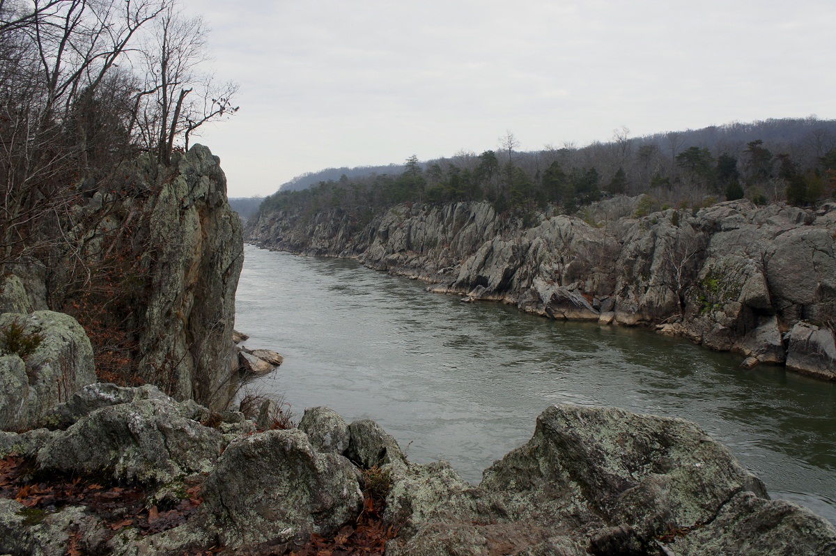
The hike to the Great Falls Loop would allow you to view the spectacular Rainbow Falls and Beaver Meadows. The trails leading to this spot include the Potomac Heritage Trail and the Fairfax Cross County Trail. As you pass by, you would come across several streams and small falls, perfect for a refreshing break on a summer day. A trip to the place in fall will surely provide the scope to enjoy the colorful foliage encompassing the area.
Length: 4.7 miles (7.6 km)
Difficulty: Moderate
The hiking trail starts from Montebello Fish Hatchery, along the Appalachian Trail, ending at the Spy Rock. As you reach the top by crossing an easy scramble, prepare for a breathtaking view of the Religious Range and other mountain summits. The place is generally not crowded. Visiting it during spring and fall would give one a perfect glimpse of floral beauty.
Length: 5.7 miles (9.2 km)
Difficulty: Moderate
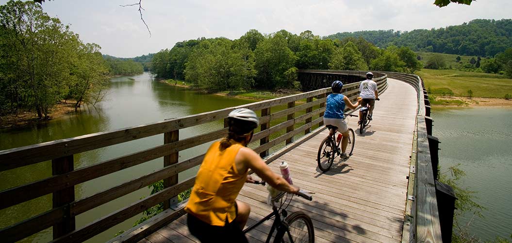
The Virginia Creeper stretching for 35 miles (56.3 km) is a recreational rail-trail situated in southwest Virginia’s Mount Rogers National Recreation Area. Its route is from Abingdon through Damascus, passing by many farms and belts of private properties. Besides hikers, bikers, cyclists, and equestrians also access this trail. One could find three visitor centers along the trail opened during weekends from May to October.
Length: 35 miles (56.3 km)
Difficulty: Moderate

This interstate park occupies parts of southeast Kentucky and southwest Virginia within the Jefferson National Forest, to the Pine Mountain’s northeast terminus. The hiking trail stretches for over 25 miles (40.2 km), with most routes being less than a mile in length and easy to cross. However, the real challenge lies in passing the interconnected ones, requiring sufficient expertise. One could even go horseback riding, biking, geocaching, and fishing, in the park’s adjacent areas.
Best Hikes in Northern Virginia: Old Rag, Great Falls Loop, Raven Rocks
Length: 25 miles (40.2 km)
Difficulty: Easy to Difficult
Most of the trails mentioned above allow dogs on leash, excepting the Old Rags, McAfee Knob, Bearfence Mountain, Dark Hollow Falls, and Dragon’s Tooth.
Best Waterfall Hikes: Crabtree Falls, Dark Hollow Falls, Cascades Falls
Hikes with Best Scenic Views: Mary’s Rock, Old Rag, Stony Man
Best Winter Hikes: Crabtree Falls, Bearfence Trail, Dark Hollow Falls

Hello there! My name is Jay and I run this website. I'm a full-time traveler and freelance writer. This is where I share travel advice and help people pursue their traveling dreams.
You can learn more about me and my mission on the about me page.
It's nice to have you here :)