Hiking the stunning trails of Arkansas will make you understand why it is nicknamed the Natural State. With so many scenic and geological wonders, they lure hikers to attempt accessing them. Most are in the state’s northern and central parts, particularly within the Buffalo River area and various state parks. If hiking these trails is on your bucket list, you could consider coming in the fall season to have an unforgettable memory of the awe-inspiring scenery each of them boasts.
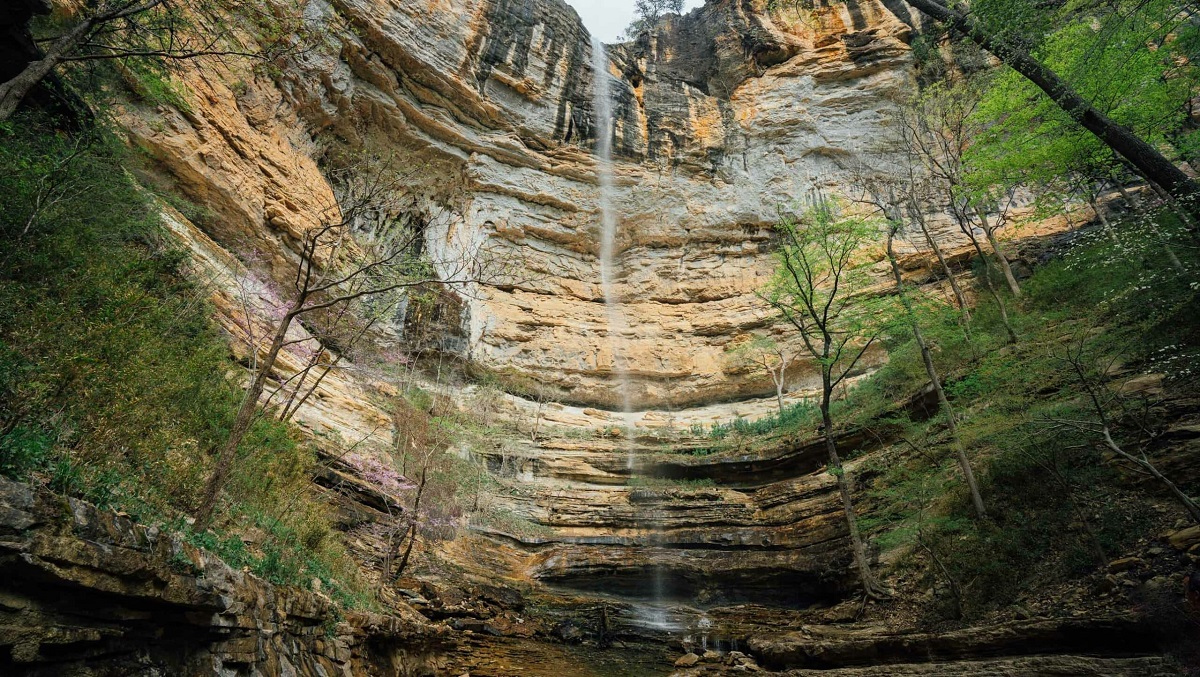
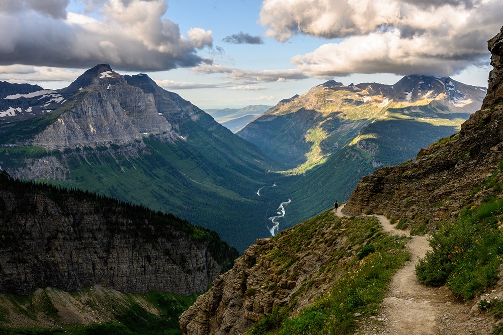
Hiking this trail in Ponca Wildnerness Area would reward you with being close to the tallest waterfall between the Appalachian Mountains in the East and the Rocky Mountains in the West. However, if you get exhausted quickly, you need to think twice before attempting it.
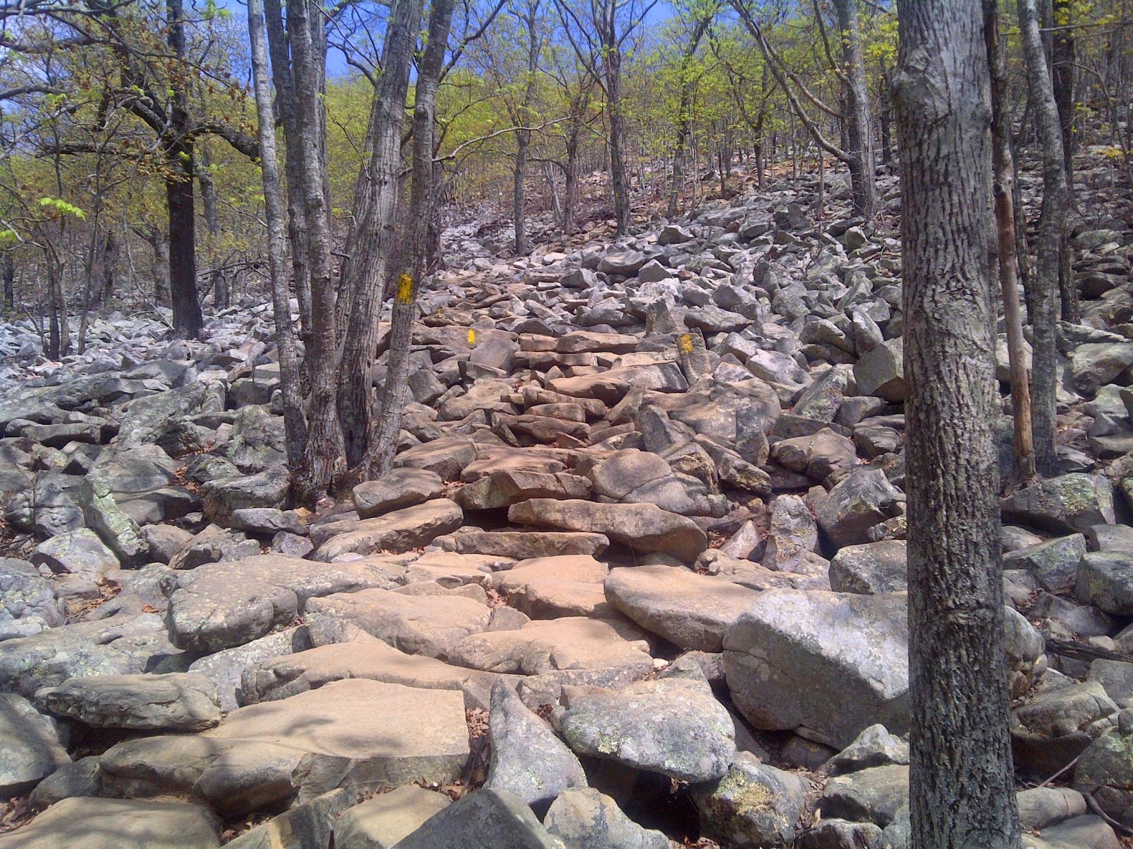
The trail begins at Compton Trailhead and continues via a steep downhill path to reach the waterfall. But, the real challenge is while returning when you will have to go uphill all the way. Climbing steep inclines and stone steps is challenging, but the entire 3-4 hours hike is well worth the view of the 209-foot tall waterfall.
While hiking, as you pause to catch your breath, the smaller cascades along the trail will surely refill your energy to move forward to your destination. Be sure to bring plenty of water and wear a good pair of hiking shoes.
Length: 5.7 miles (out and back)
Difficulty: Hard
Best time to visit: April to August
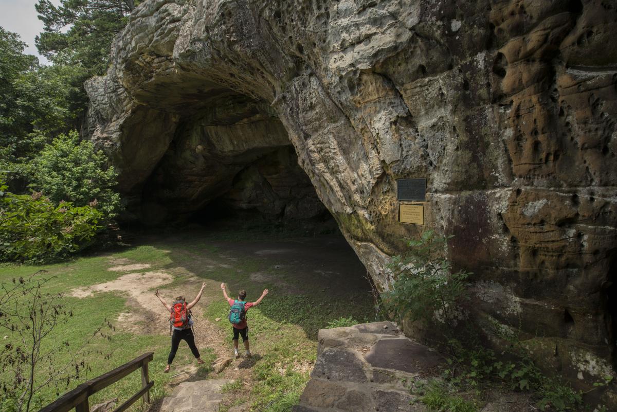
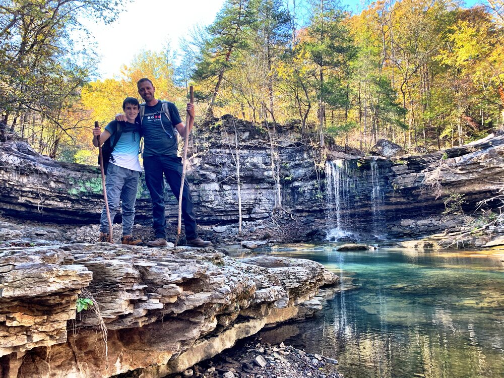
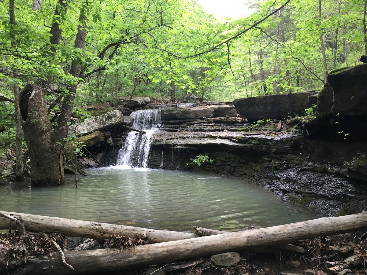
If hiking trails and exploring caves is something you enjoy, Lost Valley Trail in Buffalo National River is definitely for you. With lush foliage and rock formations, it indeed allows you to be lost in nature’s beauty.
The trail starts near Ponca, close to the Lost Valley Campground. The first flat mile is easy to access as it reaches Cob Cave, a natural bluff shelter. The trail becomes moderately challenging from here as you will have to maneuver steps to reach the final destination, Eden Caves. The gorgeous multi-tiered waterfall at the end of the cave is worth exploring, which would require you to squeeze and crawl through narrow passages to reach it. Be sure to bring a flashlight and do be careful while stepping on the rocks, which can be slippery.
Length: 2.3 miles (out and back)
Difficulty: Easy to Moderate
Best time to visit: All year round
If you’re in or around Eureka Springs, this short and easy trail is worth hiking with your family. While you enjoy the stroll through shaded trees, you can witness the lovely Crescent Spring and take a peek into the historic Carnegie Library. You can continue along the adjacent Crescent Trail or Spring Garden Loop Trail to explore further. If your dogs are accompanying you, be sure to take them to the nearby Bark Park.
Length: About 1.4 miles (loop)
Difficulty: Easy
Best time to visit: All year round
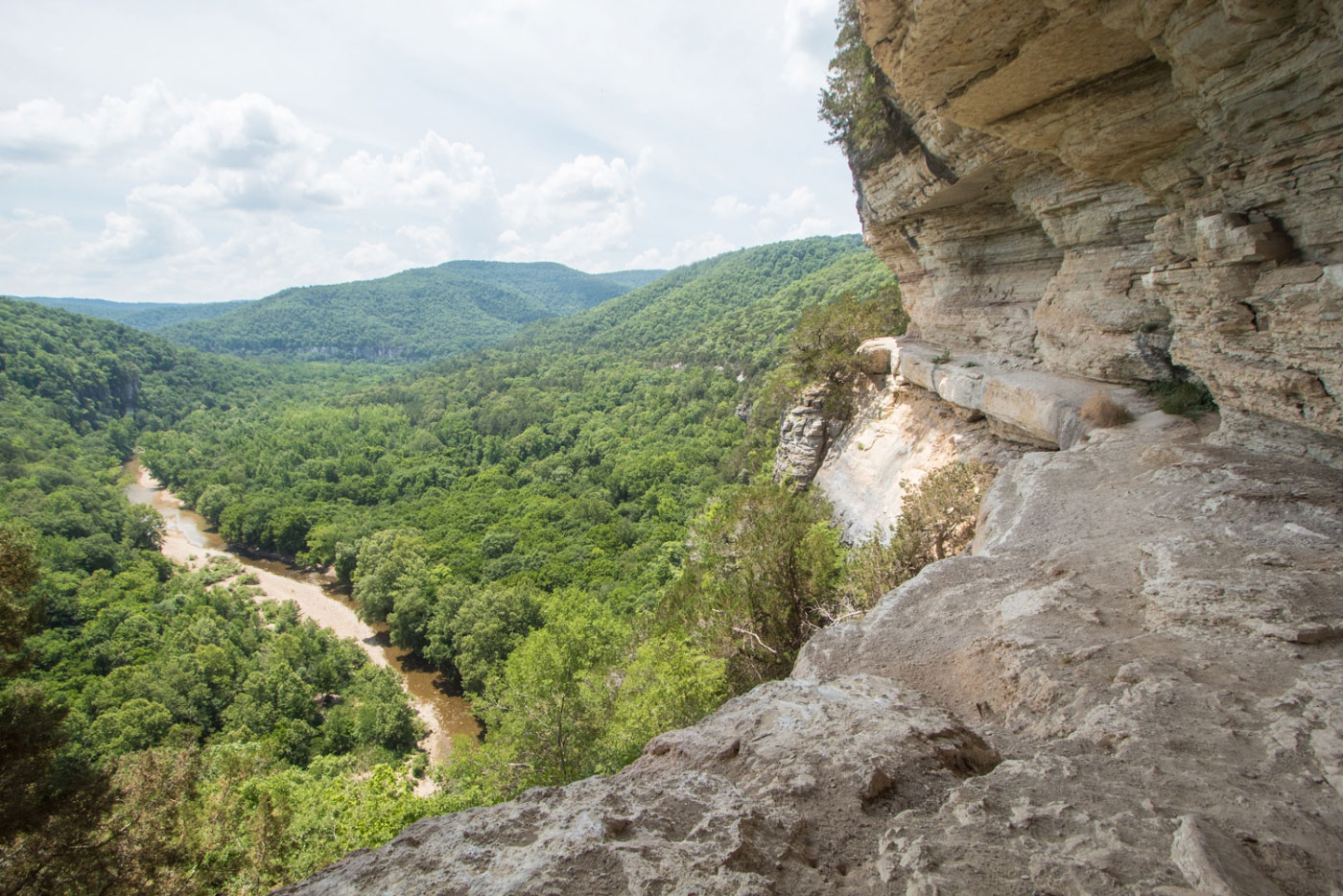
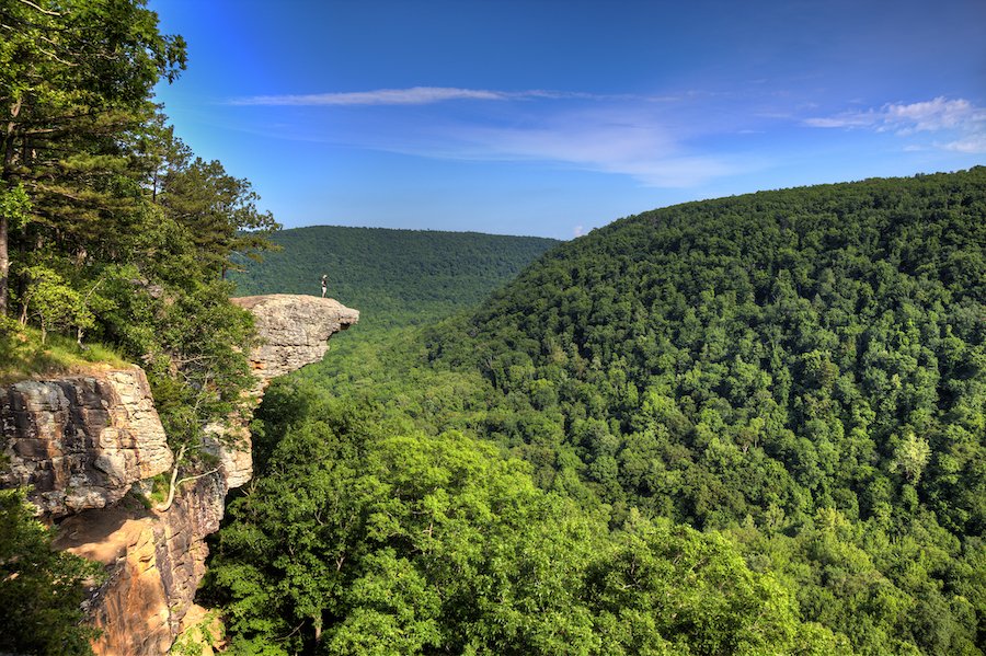
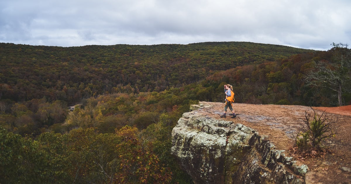
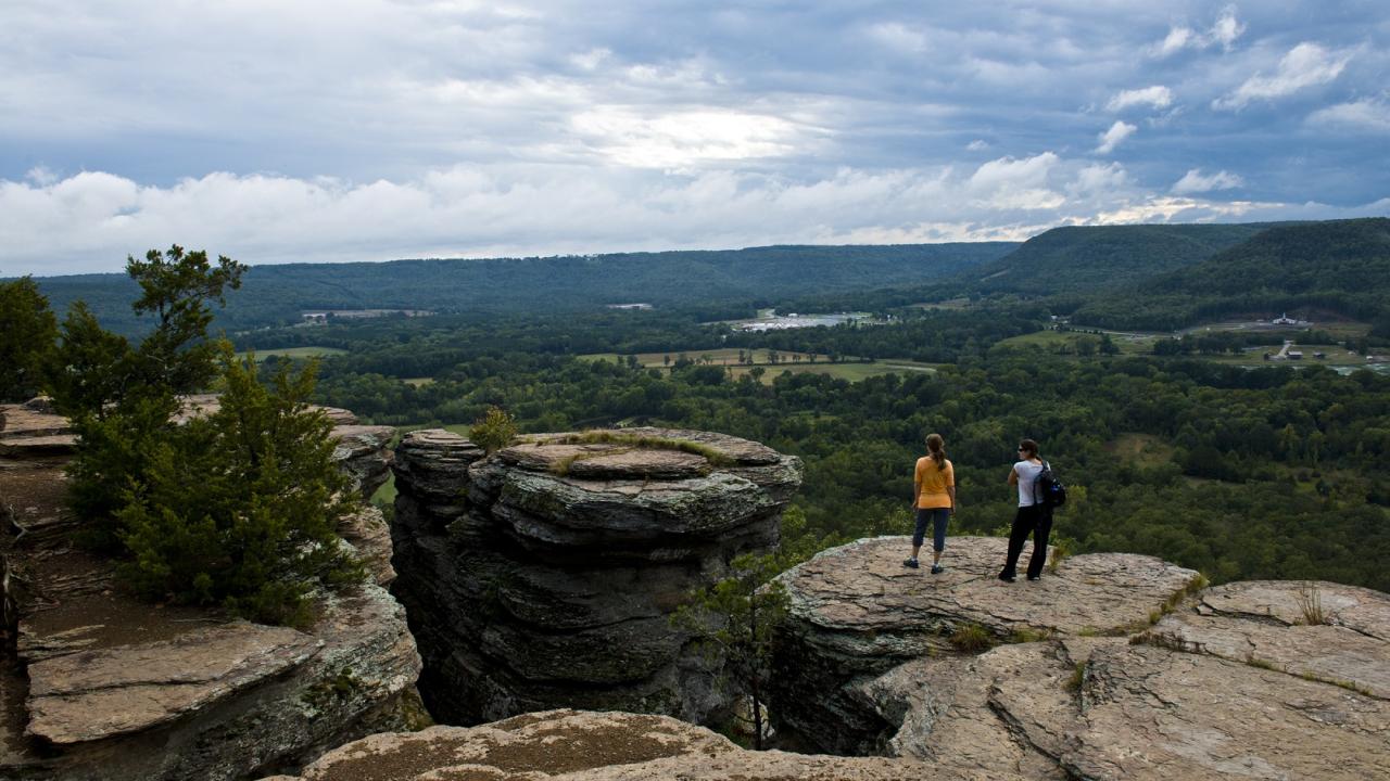
To get one of the best views of the Buffalo River, you could hike to the Big Bluff via the Goat Trail. Starting at Centerpoint Trailhead, it’s a steep hike downhill to the top of the 350-foot tall bluff. Looking down to the river from here is indeed breathtaking. Be sure to gain enough stamina before hiking out all the way uphill. Children and those fearing heights should not consider hiking this trail.
Length: About 5.9 miles (out and back)
Difficulty: Moderate
Best time to visit: All year round
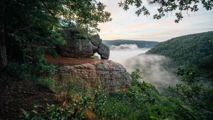
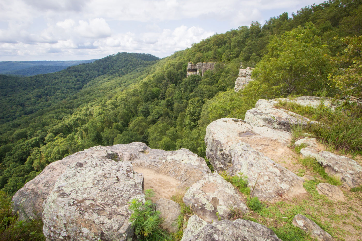
One of the most popular trails within Ozark National Forest, Whitaker Point Trail, takes you up to Hawksbill Crag. Though a short trail, it is rocky and traverses through a forested area before opening to the stunning rock formation shaped like a hawk’s beak. Once you reach the rocky viewpoint overlooking the national forest, you can enjoy soaking in the spectacular views of the picturesque valley and Whitaker Creek. Be sure to hike this trail in springtime as you will be greeted with blooming wildflowers and views of cascading waterfalls.
Length: About 2.9 miles (out and back)
Difficulty: Moderate
Best time to visit: All year long
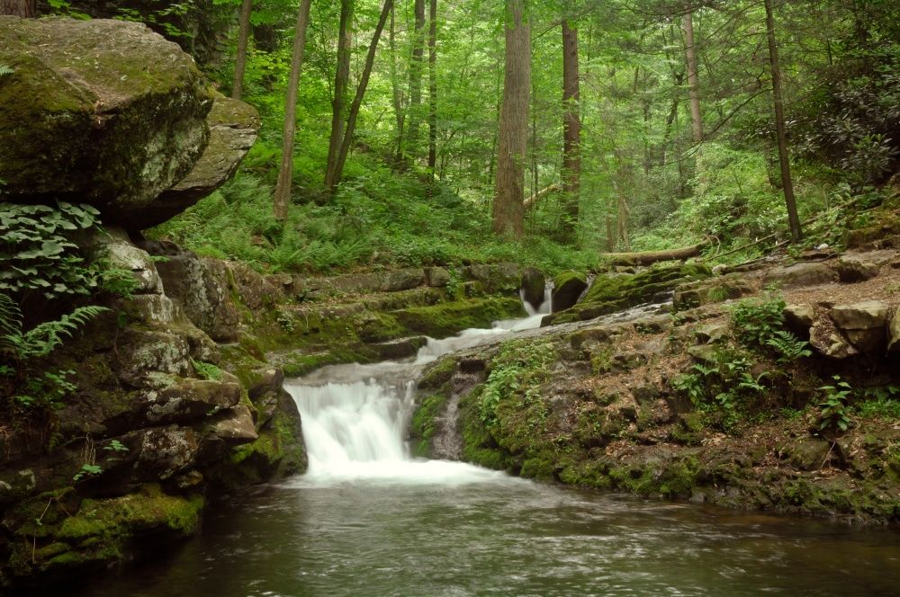
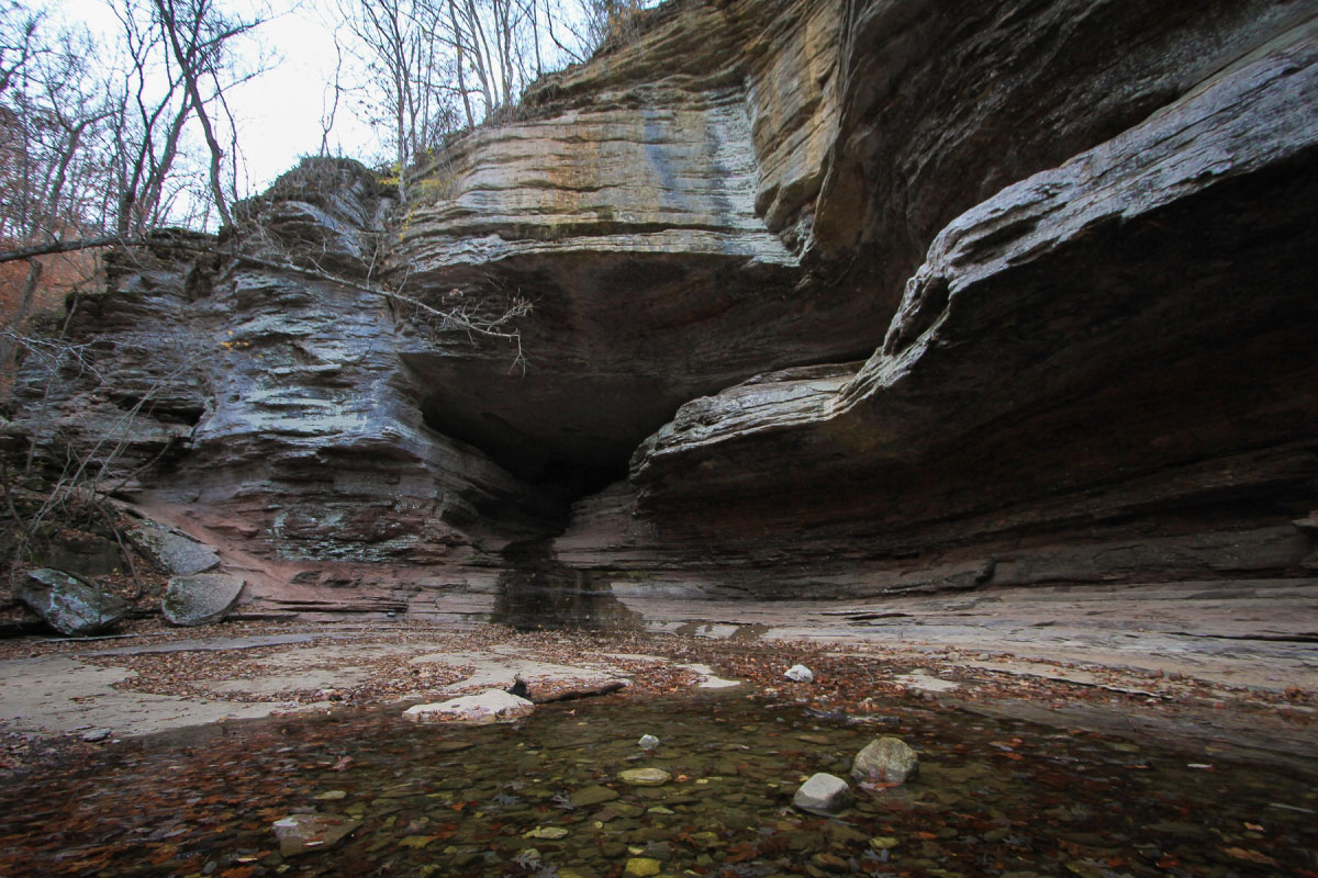
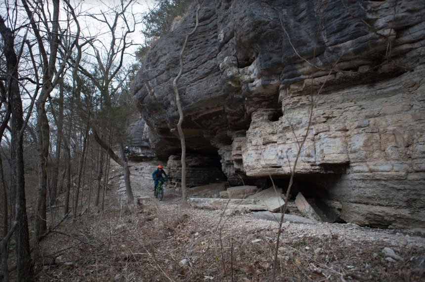
A spectacular trail in the Buffalo National River area, the Indian Rock House trail takes you along hillsides and a scenic stream before reaching Indian Rockhouse Cave. In addition, a waterfall and sinkhole would surely make you pause for a moment to admire them. The path is rocky, with many steep inclines and declines on the way. Once you reach the trail’s end, take your time to explore the cave that was once a dwelling place of Native Americans. You’ll also find natural cool springs tumbling down at the back of the cave.
Length: About 3.6 miles (loop)
Difficulty: Moderate
Best time to visit: May to October
Located a few minutes away from downtown Bentonville, North Forest Trail is a paved trail ideal for a short family outdoor trip. As the name suggests, it takes you through a dense forest with plenty of artwork to admire on the way. With benches positioned on the way, you could take a break while returning as it requires a good workout hiking back uphill. You can also carry your picnic basket to enjoy a family time under shady trees at the picnic tables.
Length: About 1.5 miles (out and back)
Difficulty: Easy
Best time to visit: All year round
One of the best scenic trails in northwestern Arkansas, Blowing Springs Trail is excellent for novice hikers to test their skills. It takes you to Blowing Springs, located in the southern part of Bella Vista. Unlike trails that require you to hike all the way to the end to enjoy a rewarding view, this trail will treat you with beautiful waterfalls, caves, and springs at every step. A major attraction is a 30-foot bridge dropping from a rock shelf to connect to the trail, where you would also find Blowing Springs Cave. Though the path comprises moderate inclines and declines, the view will surely make you forget about the challenges.
Length: About 3.8 miles (loop)
Difficulty: Moderate
Best time to visit: All year round
This trail allows you to explore the beautiful valley and waterfalls along Richland Creek. The path might seem to disappear in the middle of your hike, making it a little confusing to figure out the way. You can take the help of GPS to help you navigate the trail or try staying south of Richland Creek once you cross a small stream. Besides the scenic views, you might also encounter some wildlife species on the way. Many even attempt accessing the Twin Falls, which requires crossing the high water levels of Richland Creek.
The primitive campsites at Richland Creek Campground are ideal for spending an overnight. Putting on hiking shoes is recommended as the path is pretty slippery at some sections.
Length: About 3.5 miles (out and back)
Difficulty: Moderate
Best time to visit: All year round

Just a half an hour ride from Fayetteville will bring you to Devil’s Den State Park, home to many incredible trails, dense forests, and various rock features. You could hike the Fossil Flats Trail, which offers gorgeous views of the creek and Ozark rock formations. It is named after the flat exposed rocks and rich amount of fossils that the creek contains. Do wear waterproof hiking shoes to access the wet and muddy spots. The entire loop trail would take about 3 hours of hike to complete.
Length: About 6 miles (loop)
Difficulty: Moderate
Best time to visit: All year round
Yellow Rock Trail is one of the favorite trails among hikers in Devil’s Den State Park. It leads you to the overlook at Yellow Rock via a rocky trail. But once you make your way to the end, the enchanting view of Lee Creek Valley awaits you. Though accessible throughout the year, coming here in the fall season would make you witness the dazzling fall colors.
Length: About 3.40 miles (out and back)
Difficulty: Moderate
Best time to visit: Fall
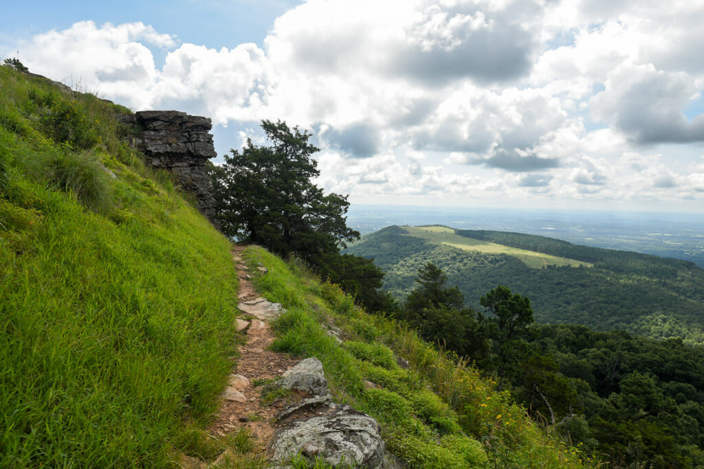
This trail loops around White Rock Mountain, offering gorgeous views of the foliage of Ozark National Forest, particularly in the fall season. Though an easy trail, it is best to avoid hiking it if height bothers you as this trail traverses along the edge of the mountain. In the end, you’ll find a shelter and benches positioned from where you can enjoy the panoramic views to the fullest. Do keep in mind that a mere fee of $ 3 is required to park your vehicle in the parking lot.
Length: About 2.1 miles (out and back)
Difficulty: Easy
Best time to visit:

North Rim Trail is one of the well-loved trails in Mount Magazine State Park for the breathtaking scenic views it boasts. Starting from the visitor center, it takes you through lush forests of hardwood, cedar, and oak trees as it crosses two creeks. You will have to hike downhill and uphill, which can be strenuous at times. However, once you reach the end, the picturesque views of the Arkansas River Valley will leave you spellbound. After spending time here, you can either return via the same path or take the spur trail connecting it to Mossback Ridge Trail. In that case, it would be a loop hike of about 4.4 miles.
Length: About 2.2 miles (out and back)
Difficulty: Moderate
Best time to visit: All year round
Though most of the section of Butterfield Hiking Trail lies within Ozark National Forest, you will find its starting and ending points in Devil’s Den State Park. The length and steep inclines and declines with loose rocks make it a challenging hike. However, many consider this trail ideal for an overnight backpacking adventure for its numerous views, including Vista Point and other creeks, waterfalls, and rock formations. Do remember to collect your backpacking permits from the Visitor Center before starting the hike.
Length: About 15.6 miles (loop)
Difficulty: Hard
Best time to visit: All year round
This trail in north-central Arkansas takes you to the top of the Sugarloaf Mountains. It requires a short and quick hike with some rock scrambles and steep sections, which is pretty fun to hike if you’re an experienced hiker. The scenery all along and views from the top make it an ideal trail if looking for a short yet challenging hike.
Length: 0.8 miles (out and back)
Difficulty: Moderate
Best time to visit: All year round
The Winding Stairs Trail near Caddo Gap in west-central Arkansas offers a unique hiking experience. It takes you past various natural features as it crosses Blaylock Creek, meanders through towering trees, and provides impressive views of numerous caves and rock formations. Towards the trail’s end, where few campsites sit, the track gets narrower and gains elevation before descending by the Little Missouri River. Once you find a way to cross it, you will be rewarded with pretty little waterfalls and an incredible rock formation shaped like a winding set of stairs.
Length: About 4.5 miles (out and back)
Difficulty: Moderate
Best time to visit: All year round
This trail is a must-hike in Mount Nebo State Park if you’re in Little Rock or Fayetteville. It is well kept and well-marked, having spectacular views throughout the way. Though there are some steep and rocky points, it is doable by hikers of all skill levels. However, a few steep declines might prove challenging for those afraid of heights.
Length: About 3.6 miles (loop)
Difficulty: Moderate
Best time to visit: March to October
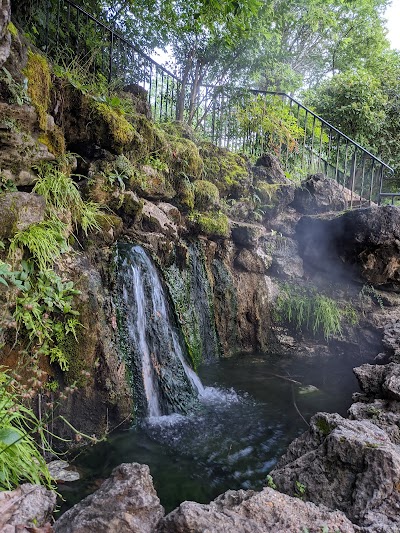
While you are at Hot Springs National Park, be sure to access this trail. Don’t underestimate its short length, as it would surely surprise you with the unique natural wonders it displays. Starting at Arlington Lawn, the path takes you to a stunning geological feature of calcium carbonate called Tufa. Along the way, you would surely be mesmerized by the views of hot waters tumbling down Hot Springs Mountain into two thermal pools. Also, as a bonus, you might catch a glimpse of little animals scurrying by or birds flying overhead.
Length: 0.6 miles (out and back)
Difficulty: Easy
Best time to visit: All year round
You will find this trail leading to the summit of Pinnacle Mountain. However, don’t be fooled by its short length, as it requires a challenging climb over rocks and boulders. However, it’s totally worth the arduous hike as you will be rewarded with breathtaking views of Lake Maumelle, the Ouachita Mountains, Arkansas River Valley, and West Little Rock. Do expect the trail to be crowded, particularly on weekends, due to its location near the capital city, Little Rock.
Length: About 1.5 miles (out and back)
Difficulty: Hard
Best time to visit: All year round
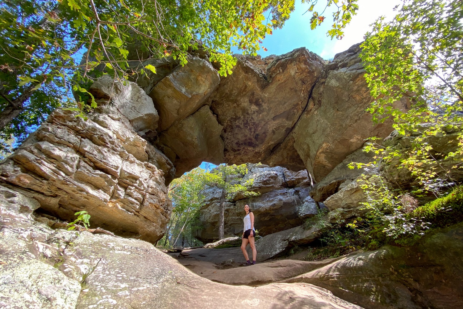
This trail in Petit Jean State Park has some impressive geological features. It is pretty strenuous, requiring you to climb over rocks and hike along steep inclines and declines. It is best attempted by those who are physically fit and have intermediate hiking skills. On your way, you can pause to take in the views of the trail’s highlights which are the natural bridge and the grotto. In addition, the fascinating rock formations, waterfalls, and bluffs all along are an added treat to the eye.
Length: About 5 miles (loop)
Difficulty: Moderate
Best time to visit: All year round
TOP PICKS
Best Waterfall Hikes: Hemmed-in Hollow Falls Trail, Indian Rockhouse Trail, Lost Valley Trail
Best Camping Hikes: Richland Creek Campground Trail, Lost Valley Trail, Butterfield Hiking Trail
Best Fall Season Hikes: Yellow Rock Trail, Lost Valley Trail, White Rock Rim Trail
Best Mountain Hikes: Sugarloaf Mountain Summit Trail, White Rock Rim Trail,Pinnacle Mountain West Summit Trail

Hello there! My name is Jay and I run this website. I'm a full-time traveler and freelance writer. This is where I share travel advice and help people pursue their traveling dreams.
You can learn more about me and my mission on the about me page.
It's nice to have you here :)