Vermont may be a small state, but its diverse topographies give way to some of the best hiking trails. Some lead to the state’s tallest waterfalls and others to the mountain summit with breathtaking views. In addition, the Long Trail that winds along the heart of Vermont is the nation’s oldest long-distance route. Depending upon your skill level, you can enjoy exploring one suitable for you. Also, they are spread in every part of the state, and most of them are accessible all year long.
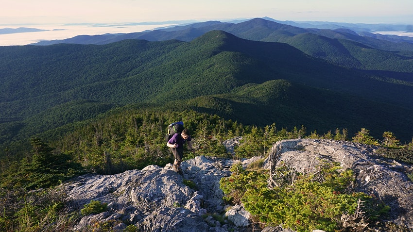
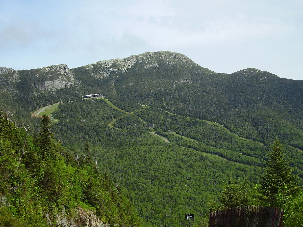
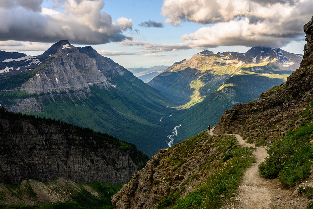
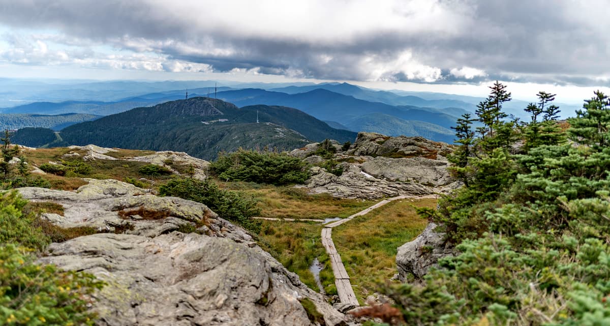
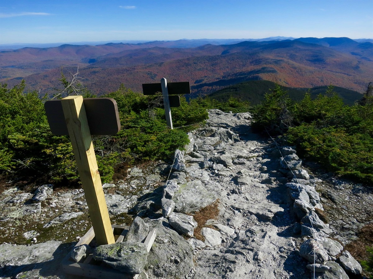
Among the many routes leading to the summit of the state’s highest, Mt. Mansfield, hikers can choose the loop trail. The uphill scrambling and exposed parts make it challenging, unsuitable for the faint of hearts and those with fear of heights. It is best to start counter-clockwise, the most strenuous section being hiking up Maple Ridge. There’s also a part where you will have to leap over a chasm, but don’t worry, as it is doable for an average-level hiker. Wearing sturdy hiking shoes is necessary for maneuvering the rocks. Pack your lunch to enjoy on the top while admiring the views. The trailhead begins from the parking lot at Uphill State Park, where you must pay $ 4 per vehicle. One of Vermont’s best trails, it requires about 6 hours to complete the hike.
Length: About 7.3 miles (loop)
Difficulty: Hard
Best time to visit: All year round
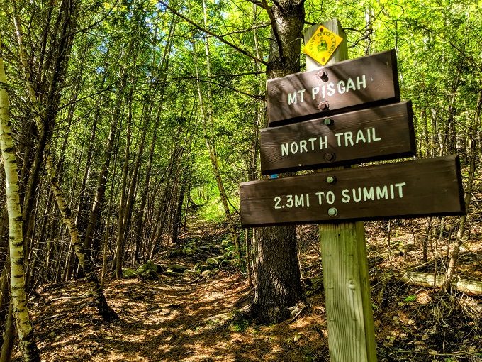
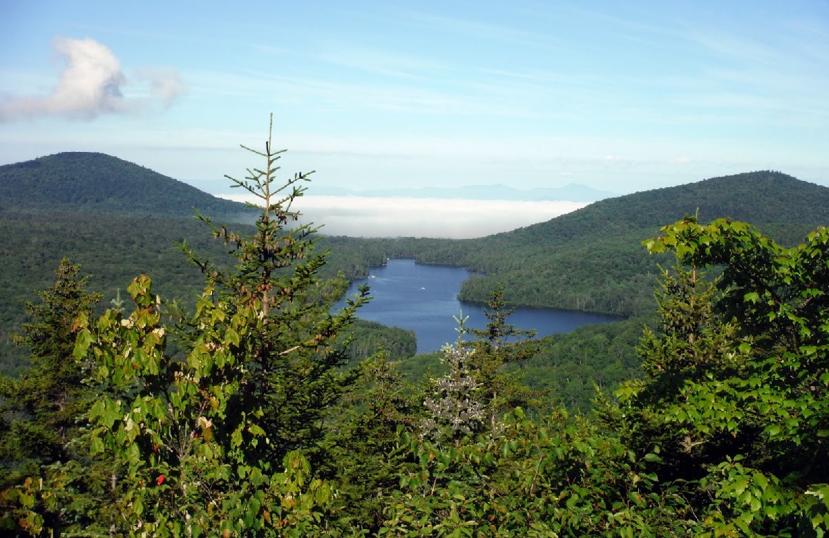
This scenic and shaded trail takes you to the top of Mt. Pisgah. The uphill climbs followed by flat stretches make the hike less challenging, but strenuous particularly for novice hikers. There are many overlooks on the way to the top. On a clear day, you’ll get the best views of Lake Willoughby and the lush surroundings, especially if you hike past the summit. Make sure to start early to beat the crowd. It will take about 2 to 3 hours to complete the out and back trail.
Length: About 4.1 miles (out and back)
Difficulty: Easy, Hard, Moderate
Best time to visit: March to October
This family-friendly and well-marked trail starts at New Discovery Campground, offering splendid views of the Kettle Pond, Lake Groton, and the Green Mountains. Park your vehicles either at the Maintenance Road or at North Parking Lot. However, if starting from the North Parking Lot, you will have to hike an extra 0.8 miles one way. Despite the rocky trail with a few ups and downs, hikers of all skill levels can access it. There’s also a picnic pavilion on the way to the summit where you can pause to have some snacks.
Length: About 6 miles (out and back)
Difficulty: Moderate
Best time to visit: All year round
This family-friendly and well-marked trail starts at New Discovery Campground offering splendid views of the Kettle Pond, Lake Groton, and the Green Mountains. Park your vehicles either at the Maintenance Road or at North Parking Lot. However, if starting from the latter spot, you will have to hike an extra 0.8 miles one way. Despite the rocky trail with a few ups and downs, it can be hiked by anyone. There’s also a picnic pavilion on the way to the summit where you can pause to have some snacks.
Length: About 3.2 miles
Difficulty: Easy
Best time to visit: March to October

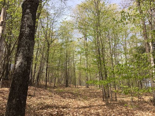
This trail is a part of the section where the Appalachian Trail joins the Long Trail. As it passes through hardwood forest, it boasts scenic views of several stream crossings and rock formations. It can be muddy, so wearing proper footwear is recommended. Although strenuous at times, you will have fun scrambling over the rocks. After enjoying the views from the summit, don’t miss hiking further to witness the Taconic Mountains. Going half a mile south will bring you to Spruce Peak Shelter, a rustic cabin accommodating 16 people. The entire hike takes about 3 hours to get done.
Length: About 4.8 miles (round trip)
Difficulty: Moderate
Best time to visit: May to October
Many trails sit within Smugglers Notch State Park, accessible by novice and experienced hikers alike. For a short and easy hike, Bingham Falls Trail would be ideal. However, you will have to hike down the stair-like rocks to reach the lovely waterfall. Do pack your swimsuits if you want to enjoy playing in the water. If visiting in the rainy season, be careful with the slippery rocks.
If wishing to hike a more strenuous trail, you can choose the Sterling Pond Trail. The course begins from across the parking lot with stone steps for some distance. It then winds through deciduous forest and can be slippery and muddy. Climbing up the steep terrain along with some scrambling before you reach the pond are the challenging parts. However, the mesmerizing views of the pond and the surrounding mountains will take away all your weariness.
Length: Bingham Falls Trail (0.5 miles, out and back), Sterling Pond Trail (About 2.3 miles, out and back)
Difficulty: Bingham Falls Trail (Easy), Sterling Pond Trail (Moderate)
Best time to visit: All year round
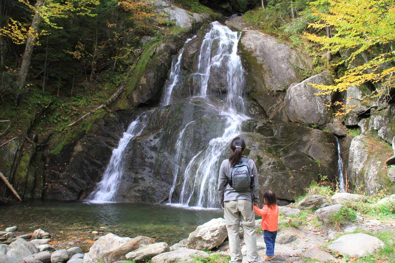
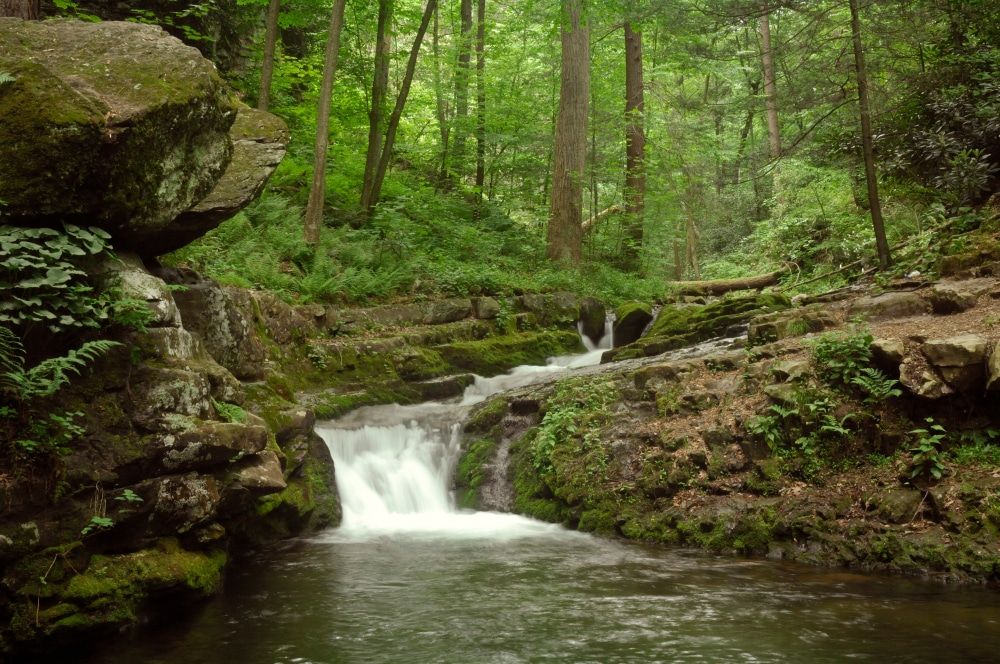
Hiking this short and easy trail will bring you to the awe-inspiring Moss Glen Falls just a quarter-mile distance from this trailhead. owever, one needs to maintain caution about the slippery rocks and exposed roots on the way. Though there is no proper signage to direct one to the falls, the path from the parking area is quite obvious and easily understandable. As it is a very short hike, many continue past the waterfall along an unmaintained trail that follows an old woods road. While returning, you can pause at the stream and enjoy splashing waters.
Length: About 0.5 miles (round trip)
Difficulty: Easy
Best time to visit: May to October
This trail, also shared by bike riders, is easy and flat for about the first two miles starting from Jamaica State Park. Clean and well-marked, the path traverses along a picturesque stream. The last mile to the waterfall, however, is steep, where the actual hike begins. But, the view of the gorgeous waterfall is well worth it. Do keep in mind not to swim because of the strong water currents and slippery rocks here. Over twelve people have lost their lives in the past while attempting to swim here.
Length: About 5.8 miles (out and back)
Difficulty: Moderate
Best time to visit: April to October
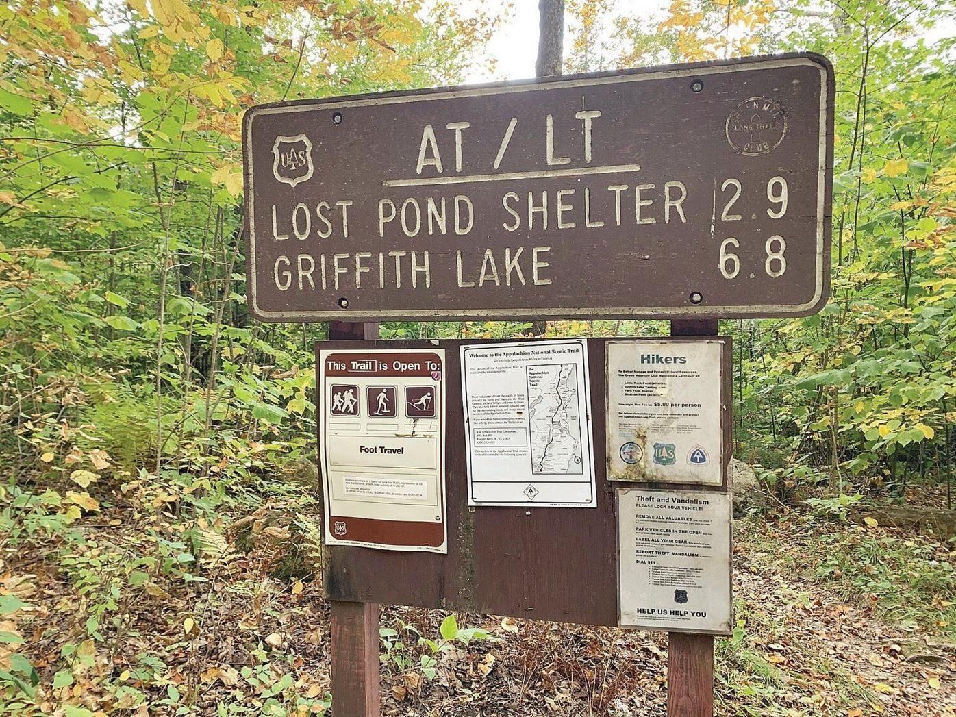
This oldest long-distance hiking trail in the United States, Long Trail, stretches from the Massachusetts-Vermont state line to the Canadian border. As it traverses through Vermont, it boasts varied terrains, enjoyable for the day-hikers and backpackers alike. Though a challenging hike, numerous shelter spots and plenty of water sources provide hikers some comfort. The views are, of course, a bonus.
If you want a day hike, you can climb Mount Abraham’s summit from Lincoln Gap. It is about 6 miles (out and back), offering picturesque sceneries from the mountain top of the surrounding valleys, mountains, and Lake Champlain. For a backpacking adventure, you can consider choosing the 17-mile trail from Lincoln Gap to Middlebury Gap. It is a pleasant section of the Long Trail with four shelters.
Length: Lincoln Gap to Mount Abraham (About 6 miles, out and back), Lincoln Gap to Middlebury Gap (17 miles)
Difficulty: Moderate to Hard
Best time to visit: May to October
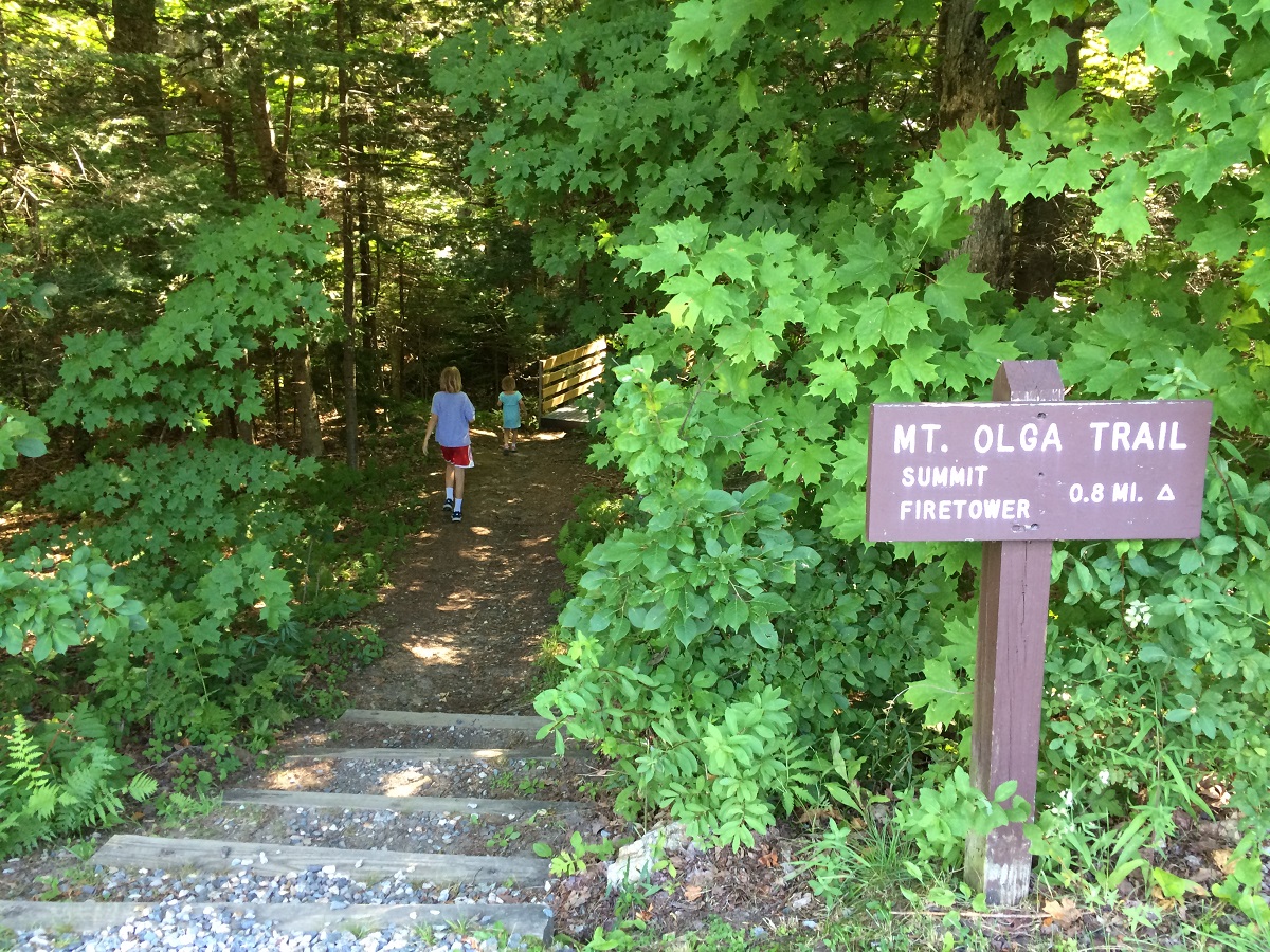
This shaded trail begins from Molly Stark State Park, perched on the southern Green Mountains. Its inclines and declines make it moderately difficult, but hikers of all skill levels can tread along the short distance. The blue blazes are well marked, and you can also bring along your dogs with you. As for the views, it is best if you climb up the fire tower once you reach the trail’s end to get the incredible panoramic vistas of the encompassing mountains. You will have to pay $ 4 per person to enter the state park.
Length: About 1.8 miles (loop)
Difficulty: Easy to Moderate
Best time to visit: May to October
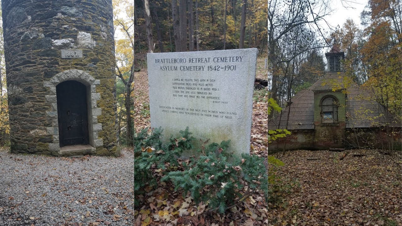
This trail network offers a pleasant hike with several signs along the way giving information about the area’s flora as it meanders through the forests. You can start either from the parking lot at Retreat Farm or from the northern trailhead on Upper Dummerston Road. Though some are challenging and others pretty easy, all these trails offer impressive viewpoints and features along the way, including Retreat Tower and Ice Pond. One of them even leads to the top of Harris Hill, where ski jumping competitions take place. The view from there is incredible. On your way back, make a stop at the Retreat Farm for some refreshments and to visit the petting zoo. If coming in winter, you can enjoy cross-country skiing or snowmobiling along the one-mile loop, Woodlands Interpretative Trail.
Length: 9 miles
Difficulty: Moderate
Best time to visit: All year round
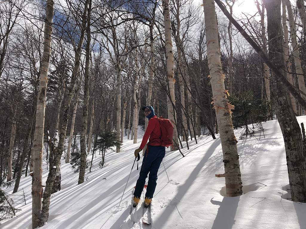
This trail is mainly used for cross-country skiing in winter, but many also enjoy hiking on it. However, as it remains exposed to roots and rocks during other times of the year when the surrounding landscape is not snow-covered, treading along it can be pretty challenging. Besides this, it promises beautiful views of the surroundings as it overlooks the Somerset Reservoir. Remember to apply some bug spray before starting your hike. You can also indulge in additional activities like kayaking, fishing, or camping here.
Length: About 7 miles
Difficulty: Moderate
Best time to visit: All year round
This well-maintained and shaded trail is suitable for hikers of all skill levels. It takes you to the fire tower, climbing on which will reward you with awe-inspiring and far-reaching views of Mount Ascutney and Mount Killington. As the trail mainly consists of several stone steps, those not physically active might find it challenging to tread. Due to the crowded paths on weekends, it is better to go on weekdays or early morning. Your dogs, too, can accompany you.
Length: About 1.5 miles (round trip)
Difficulty: Easy
Best time to visit: March to October
There are many more trails within the Green Mountain National Forest area. Advanced-level hikers can hike the Killington Peak via Bucklin Trail. The first two miles are relatively flat, but the last section before reaching the summit is extremely steep. The uphill climb and scrambling over boulders are what make the hike difficult. After reaching the top, the panoramic views of the distant Adirondacks of New York and the White Mountains of New Hampshire is a spectacular sight. If visiting in winter, make sure to wear micro-spikes or snowshoes.
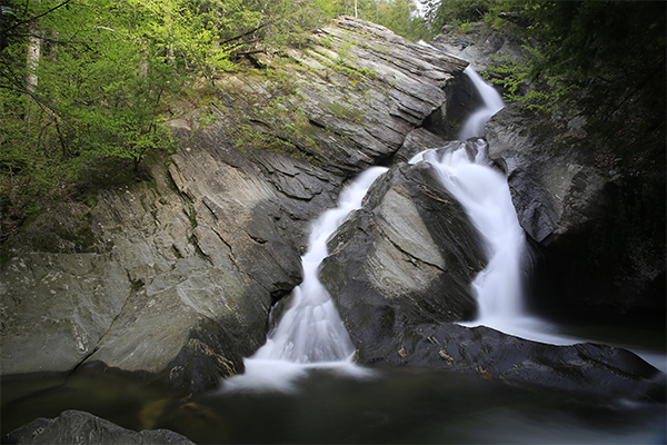
For a comparatively easier hike, the Lye Brook Falls Trail would be ideal. Following the well-marked blue blazes, you will traverse through forested areas before reaching the splendid 125-foot waterfall. Only the last uphill part is most strenuous with steep inclinations.
Length: Killington Peak via Bucklin Trail (About 7.5 miles, out and back), Lye Brook Falls Trail (About 4.5 miles, out and back)
Difficulty: Killington Peak via Bucklin Trail (Hard), Lye Brook Falls Trail (Easy to Moderate)
Best time to visit: March to October
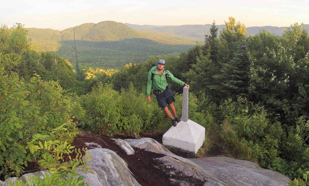
The Appalachian Trail runs along 14 states, and a significant part of it also falls in the state of Vermont. It coincides with the Long Trail and includes many sections traversed by day-hikers or backpackers. Among these, you can do the Bromley Mountain via Long Trail/ Appalachian Trail. The creek running alongside and the wildflowers will keep you treading along the steep inclines. The trail is well-marked, the views from the top being a treat to the eyes.
Another well-traversed track to choose is the Pinnacle at Windmill Hill Loop. It has relatively low elevation gains, and the informational signs all along are pretty fascinating. You can enjoy your meals at Pinnacle while soaking in the captivating views. There is also a shelter where you can spend an overnight.
Length: Bromley Mountain via Long Trail/ Appalachian Trail (About 6.2 miles, out and back), Pinnacle at Windmill Hill Loop(About 4 miles, out and back)
Difficulty: Bromley Mountain via Long Trail/ Appalachian Trail (Moderate), Pinnacle at Windmill Hill Loop (Easy to Moderate)
Best time to visit: All year round
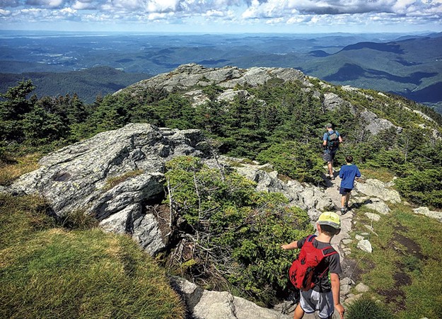
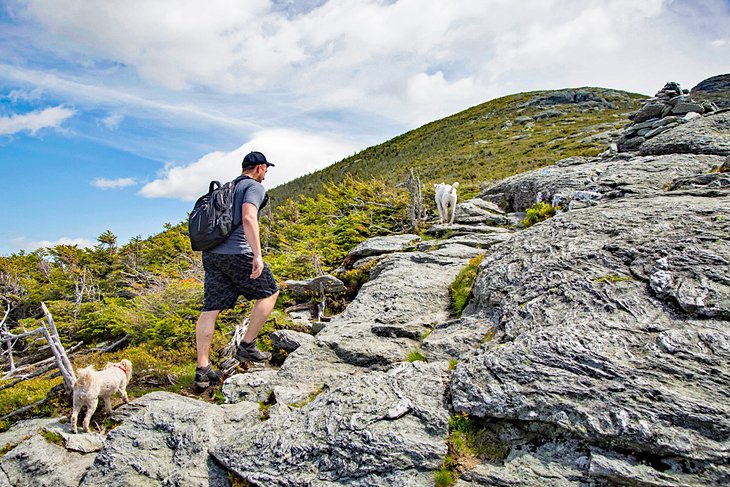
The trailhead to the state’s third-highest, Camel’s Hump, is from the parking lot off Camel’s Hump Road. You can either take the Monroe Trail to the summit and back or consider taking the loop combining Monroe Trail, Dean Trail, and Long Trail. Climbing up the rocky and steep parts is pretty strenuous, especially in the last section. If you’re lucky enough to end on the top on a clear day, the panoramic views of the surrounding are sure to woo you. Going down is equally challenging, so take a break to remove your weariness before coming back. Bringing your hiking poles and wearing hiking shoes would help you traverse this trail, which would take around 4 to 5 hours for the entire hike.
Length: About 6 miles (out and back)
Difficulty: Moderate to Hard
Best time to visit: All year round
This section of Long Trail, starting from Lincoln Gap, is one of the most scenic ones. As it meanders through firs and spruce forests, you will have to tread along a rocky path all the way. The last portion of about half a mile is the steepest, requiring scrambling over the huge rocks. On getting to the summit, the 360-degree views are indeed rewarding after the strenuous effort. On a clear weather day Mt. Washington, Lake Champlain, and even the Adirondacks in New York will be visible. The entire hike takes around 4 hours, and you can visit the nearby Bristol Falls for a refreshing swim in the pool at its base.
Length: About 5 miles (out and back)
Difficulty: Moderate to Hard
Best time to visit: May to October
TOP PICKS
Best Mountain Hikes: Mt. Mansfield Trail, Mt. Pisgah Trail, Camel’s Hump Trail
Best Waterfall Hikes: Hamilton Falls Trail, Moss Glenn Falls Trail
Best Fall Hikes: Owlshead Mountain Trail, Gile Mountain Trail, Smugglers Notch Trails
Best Kid–friendly Hikes: Owlshead Mountain Trail, Gile Mountain Trail, Moss Glenn Falls Trail
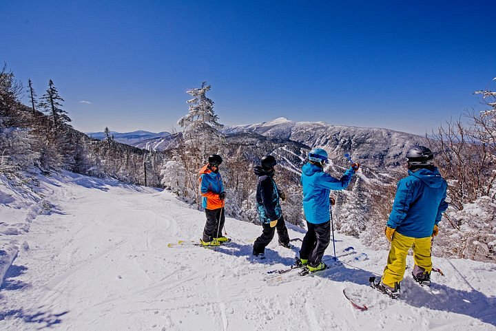
Best Winter Hikes: Catamount Cross-Country Trail, Camel’s Hump, Smugglers Notch Trails

Hello there! My name is Jay and I run this website. I'm a full-time traveler and freelance writer. This is where I share travel advice and help people pursue their traveling dreams.
You can learn more about me and my mission on the about me page.
It's nice to have you here :)